

Cherokee Hiking Club Calendar
2022
Hike Difficulty Rating Scale (per Chattanooga Hiking Club)
CHC Hike Calendar for 2022 - good for printing
Jan Feb Mar Apr May Jun Jul Aug Sep Oct Nov Dec
Benton MacKaye Trail Assn Hike
Schedule
Cleveland Greenway walks each Wednesday. Contact Leader Jack Callahan for meeting time/place info at 423-284-7885.
JANUARY 9, 2022 SUNDAY - ANNUAL PLANNING MEETING - 2 PM WESLEY MEMORIAL METHODIST CHURCH ETOWAH TN - Our annual Club Planning meeting will be held on Sunday afternoon, January 9, at 2:00 pm. We will be meeting in the fellowship hall of the Wesley Memorial United Church in Etowah, TN. It is located at 923 Ohio Ave. It's just about a block off Hwy. 411. All Club members are welcome. This is the meeting where we put together our annual calendar of activities for the upcoming year. If you would like to lead a hike or activity, please list it on a sheet of paper and bring it to the meeting. Please include the following information: Your name as Hike or Activity Leader, the specific hike/trail/activity, the date or dates you plan to offer it, and a description of the hike or activity. Include info such as how many miles to be hiked and whether it is easy, moderate or strenuous. By having this written down, it will really help us in getting the calendar typed up and put on our website. Also, please note that if you are not able to attend the meeting in person, you should email this information to James Anderson at jeandersonishere@gmail.com ahead of time so it can be discussed and included. Light refreshments such as water, soft drinks, and cookies will be served. If you have any questions, please call or text me at 423-715-8824. • James Anderson
January 21 at 6 pm. Club will have a booth at Westmore Church of God Outdoor Dinner.
January 20 at 8:30 am. Breakfast at Old Fort Restaurant. Leader Jack Callahan.
January 28 Hike on Childer's Creek section of BMT near Reliance. Hike is 6 miles total and is considered moderate due to section in the middle where there are big rock steps and narrow trail. Meet at 10 am at Childer's Creek trailhead parking area. If interested in carpooling from Cleveland, contact hike leader James Anderson at 423-715-8824. Bring water and lunch or snacks. Hike Report: There were eight hardy hikers who showed up for our hike of the Childers Creek section of the BMT. Although it was cold and cloudy, we enjoyed the walk. Even though we had a few snow flurries, we were quite surprised to see a quince in bloom and some daffodils about to bloom. Also included in the photos is a piece of driftwood with a lot of interesting curves.
• James Anderson
Cleveland Greenway walks each Wednesday. Contact Leader Jack Callahan for meeting time/place info at 423-284-7885.
February 4-6 Lookout Wild Film Festival in Chattanooga. Google for more info. Trip Report: Four club members attended the festival this year and enjoyed numerous films about the outdoors. Between the afternoon and evening events on Saturday, the group ate supper at the Community Pie just a short stroll from the Tivoli Theatre where the event was held. Film topics included events on kayaking in Africa and on the Colorado River through the Grand Canyon, mountain climbing in Patagonia, mountain biking in several locations in the state, snorkeling during a tadpole migration, and cross-country hiking across southern Iceland to name a few. During intermission in the afternoon session, the two oldest individuals to hike the Appalachian Trail were introduced and took questions from the audience. Club members attending were Jennifer Schroll, Mitchel Schroll, Margaret Callahan, and Event Leader Jack Callahan. • Jack Callahan
February 10 Club meeting at 6pm Seniior Center Elowah. Bring your favorite dish for the potluck dinner. The Club will be furnishing drinks, cups, and plastic eating utensils. The program is Backpacking for Beginners by Jack Callahan, Jennifer Schroll, Sue Robinson and others. Mtg Report: After the business meeting led by James Anderson and potluck supper, Jennifer Schroll, Jack Callahan, and James Anderson conducted a discussion on backpacking gear, with examples of all the equipment typically used in an overnight trip. Discussions included water treatment, sleeping bags, tents, packs, cooking equipment, and food. As part of the potluck, Jennifer prepared one of her backpacking meals which included Stove Top stuffing, chicken, and cranberries. Jack had one of his favorite snacks, Nutella and Frito chips. This presentation was to get some members interested in backpacking. As a follow-up, there will be an overnight backpacking trip to Bob Stratton Bald on May 15 – 16. Those interested in the overnight trip should contact Event Leader Jack Callahan at 423-284-7885 to discuss gear needs. • Jack Callahan
February 12 Visit Sequoyah Birthplace Museum in Vonore, TN. Drive from Cleveland 1 hr 20 minutes. Carpool from Cleveland will meet at Home Depot Parking lot on Paul Huff Parkway at 8:30 am. Museum opens at 9:00 am. After touring museum eat a late lunch in Vonore. Event leader is Jack Callahan 423-284-7885. Trip Report: A baker's dozen met and toured the museum near Vonore, TN. The museum is very well-done and takes you through the life of Sequoyah and his development of the written Cherokee language. On the grounds, there are additional exhibits and gravesites of some of the Cherokee people whose remains were reinterred before the lake was filled. Afterwards, the group split up and several folks went to Madisonville and the rest stopped in Vonore for lunch. Attendees included members Ann and Bill Gray, Ruth and Clayton Pannell, Yvonne Rittenhouse, Karen Kocher, Judy Price, Carin Taber, Maryl Elliot, Margaret Callahan and Event Leader Jack Callahan, and visitors Victoria Bailey and Kelly Kissell. • Jack Callahan
February 15 Walk in the Woods. Meet at Johnston Woods trail parking lot just off Hwy 11 S and near the former Bachman Home at 10 am. We will walk the 1.2-mile trail first, and then the 2.9-trail for a total of 4.2 miles. Considered easy. Hikers may walk one or both trails as they connect at the parking lot. Hike leader is James Anderson 423-715-8824. Trip Report: It was really good to see a total of 15 persons show up for our first Walk in the Woods at Johnston Woods off South Lee Highway. It was a real treat for us to see an owl perched in a tree just a few feet off the trail. It stayed for a few pictures but then flew just a bit further away. We also saw some interesting trees but, best of all, just enjoyed the fellowship and a peaceful walk in the woods. Hope you will consider joining us the next time we do this. You can do the 1.2-mile loop or that one and the 2.9-mile loop for a total of 4.1 miles. • James Anderson
February 17 at 8:30 am. Breakfast at Old Fort Restaurant. Leader Jack Callahan. Seven members met to enjoy breakfast on our regular third Thursday outing. As always, there was lively conversation and great food. Hard to beat those hot biscuits and apple butter! Members attending were Jennifer Schroll, Ann and Bill Gray, Gail and Edmond Gray, Carin Taber and Event Leader Jack Callahan. • Jack Callahan
FEBRUARY 19 - SECTION 12e OF BMT/LOST CREEK TRAIL TO WHITE OAK FLATS ROAD - Seven club members and one energetic canine hiked the majority of Section 12e of the Benton MacKaye Trail (all but the road portions) on a beautiful February day. We enjoyed fantastic views of gorgeous, crystal-clear Lost Creek on the in-and-out trip which totaled about eight miles. We also witnessed Judy Norton make quick work of some downed tree limbs with her miniature battery-powered chainsaw going in, and a handsome whitetail buck on the return trip. Special thanks to James Anderson for assisting with the car shuttle across McFarland branch to the trailhead as it saved some hikers from wet feet at the onset of the hike. Hikers were Mary Alton, Anne Anderson, James Anderson, Judy Norton, Sue Robinson (and dog Zoe), Carin Taber, and Hike Leader Randy Morris. • Randy Morris
February 19 Rock Creek Trail hike in Little Frog Wilderness. We will meet at Thunder Rock Campground parking lot at 9 am for the quick car shuttle to the trailhead. Approximately eight miles beginning at Rock Creek trailhead on Hwy 64 and returning downhill via the Dry Pond Lead Trail (Benton MacKaye Trail). There is a small stream crossing at Laurel Creek, which is usually easy; but crossing Rock Creek will require fording the cold-water stream. Water shoes and hiking poles for balance are highly recommended. Along the way, there should be great views of the nearby mountains as the trail goes up the side of Panther Knob and into the beautiful Pressley Cove where Rock Creek is encountered. The trail is considered strenuous due to the length of the hike and several moderate climbs. The hike will be canceled in the event of snow/ice on the roads. Contact Hike Leader Randy Morris at 423-650-0485. This hike was changed to the Lost Creek Section of the BMT because of two similar hikes.
Cleveland Greenway walks each Wednesday. Contact Leader Jack Callahan for meeting time/place info at 423-284-7885.
March 3 Lowery Top overlook hike. Moderately strenuous 8-mile roundtrip utilizing 2.75 miles of Oswald Dome Trail. Requires approximately 1 mile of bushwhacking. Pack a lunch for picnic at overlook. Meet at the Quinn Springs Picnic Shelter on Hwy 30 near Reliance at 9 am. Hike has close to 2000 feet of elevation gain. Hike Leader is Jack Callahan 423-284-7885. Trip Report: Fourteen hearty souls, including Hike Leader Jack Callahan, made the eight-mile round trip up Oswald Dome Trail to an undisclosed turn, thence through the woods to Lowry Top. Finding the exact location, the group enjoyed the special view of downtown Reliance. There is only one location where the view is unobstructed. The weather was excellent for hiking and a pleasant lunch at the viewing spot. Hiking back there was one sandy spot in the trail with what looked like a very large cat track. The trailing arbutus was just beginning to bloom, as were catsfoot, or everlasting, known by several different names. The group made its way back down to Quinn Springs parking lot, and all fourteen were accounted for. It is a somewhat difficult hike due to the 2000-plus foot elevation gain, but all agreed it was well worth it.
• Jack Callahan
March 5 Dry Pond Lead Hike on the BMT - We will meet at the Thunder Rock Campground parking lot at 9 am. We will hike part of Section 12 of the Benton MacKaye Trail—commonly known as the Dry Pond Lead Trail— for a total mileage of approximately nine miles. There is in excess of 1700 feet of elevation gain within the first four miles so I am rating this hike as strenuous. In fact, the first four miles are practically all uphill. There are normally great winter views of Brock Mountain, the Ocoee Gorge and sometimes Big Frog Mountain on this trail which meanders along the NW boundary of the Little Frog Mountain Wilderness Area for much of the hike. Please contact Hike Leader Randy Morris via text or call at 423-650-0485 if you are going on this hike. Trip Report: On an absolutely balmy early March day, seven, then eight hikers started near the Ocoee Number 3 Powerhouse and trekked 8-9 miles to the top of Section 12 of the Benton-MacKaye Trail, commonly known as the Dry Pond Lead Trail. The trail did not live up to its name, however, as we witnessed a small body of water alongside the trail (see accompanying picture)--possibly a small vernal pond? Although I have hiked this trail many times previously, I have never seen water near the summit. We enjoyed great views of the surrounding mountains in all directions and were able to put names to many of the peaks by use of a handy phone app. We climbed almost 1,700 feet in elevation from the gorge to one of the summits along the Little Frog Wilderness Area. After lunch near where the trail begins to head toward Kimsey Highway, we descended back down to our vehicles. Enjoying the day were visitors Tory Bailey, Janet and Rob Coombs, Joey Sloan, and Charlie Snow as well as club members James Anderson, Sue Robinson, and Randy Morris, hike leader, reporting.
March 8 Black Mtn of the Cumberland Trail - Black Mountain Trail in Crab Orchard, TN, is nine-+/- moderate miles out and back with 1600 feet of elevation per AllTrails. Meet at McDonald's parking lot in Spring City, TN, at 9:30 am EST to carpool to trailhead. (Limited parking at trailhead. Please note time may change to CST in the area.) Please text Hike Leader Sue Robinson at 423-519-9751.Trip Report: Eight hikers split into two groups: Jack and Margaret Callahan, Carin Taber, and Judy Price drove to the top of the mountain to hike the loop, while Hike Leader Sue Robinson, Mary Alton, Teresa Greene, and Lucia Case started the hike from Route 68 up the mountain. We stopped at Windlass Cave for some exploring around the cave and in the creek. We headed up the mountain where we all had our rocks to throw into the "abyss." We paused at the primitive campground to catch our breath and then made it to the "cubes" that never cease to amaze. We had clear skies for lunch at the viewpoint overlooking Grassy Cove. We then took the lower trail by the old house foundations and spring house. We explored a few more giant-sized boulders before heading back down the trail. Then we had cold drinks and a bite to eat afterward at the American Grill. • Sue Robinson
March 10 Hiking Club Monthly Meeting at 6pm. Program Glacier/Mt Rushmore slide show presented by Teresa Green. Location Etowah Senior Center. Mtg Report: Our March monthly club meeting was well-attended with regulars, several new members, and guests. There was a really nice array of great foods and desserts at the potluck, and a terrific slide presentation put on by Teresa Greene and Sue Robinson. They covered their camping/road trip to Yellowstone, Glacier, and Mount Rushmore. It was very informative and had wonderful slides of the scenery. In April, the presentation will be on local wildflowers and mushrooms presented by Mr. Leon Bates. For everyone who wants to learn to identify some of these flowers, you won't want to miss this! • Jack Callahan
March 11 Eureka Trail Hike near Englewood. Walk the Rails to Trails walkway which has a flat, good surface. It is part of the trail from Hwy 39, New Englewood Highway leading from Athens to Englewood. Eureka Trail parking lot is on the right side of Hwy 39 heading into Englewood. The trail is now 5 miles long. Each person or group can walk however far they choose. The trail is well marked every quarter of a mile. Meet at the Englewood parking lot at 10 am, weather permitting. Hike leader is Ruth Pannell 423-506-9623 or 263-9730 or email crpannell@comcast.net.
March 12 Visit to Dunlap Coke Ovens in Dunlap, TN. Easy walking tour of the facilities at the museum. Learn how coal was transformed to coke and its uses, and the operation of 268 ovens and the mines that fed them. To carpool, meet at the Park and Ride parking area near the intersection of I-75 and Georgetown Rd. at 9:30 am. The museum opens at 10 am CST. Have lunch at one of the restaurants in Dunlap after the tour. Drive time 1 hour 15 minutes. Event Leader Jack Callahan 423-284-7885.
March 17 Breakfast at Old Fort Restaurant. Event leader Jack Callahan
March 25 Walk in the Woods. Meet at Johnston Woods trail parking lot just off Hwy 11 S and near the former Bachman Home at 10 am. We will walk the 1.2-mile trail first and then the 2.9-trail for a total of 4.2 miles. Considered easy. Hikers may walk one or both trails as they connect at the parking lot. Hike leader is James Anderson 423-715-8824.
March 28 Hike to Historical Caney Creek Town Remains. The settlement is on the far side of the Ocoee River just off Hwy 64 and above Parksville Lake. There have been videos made of this former town. You can google "Extinct Town of Caney Creek Polk County TN" to watch them. To reach it by land requires an hour long each way car shuttle and 6-mile hike. The hike is rated moderate with one very steep section and requires a large stream crossing which may be 14 inches deep. Water shoes and hiking poles are highly encouraged. Also bring lunch, water, first aid kit, insect repellant, and camera. Meet at 9 am at the Thunder Rock Campground parking lot. Hike leaders are Clare and Ed Sullivan 404-849-0872 or clare7982@gmail.com. Signup is required as there is a maximum of 12 persons allowed on the hike. Trip Report: Five members and two guests enjoyed a gorgeous day on a 6.2-mile hike to the extinct village of Caney Creek. Charlie Snow, a new Cherokee Hiking Club member, shared information with us about hiking to Caney Creek twenty years ago. He had hiked down along Big Creek to the village. It was nice to have Rick and Brenda Harris back from their Florida Trail hike to join the hike. We were delighted to find American Beauty, Toothwort, and Dwarf Crested Irises blooming. • Clare Sullivan
Cleveland Greenway walks each Wednesday. Contact Leader Jack Callahan for meeting time/place info 423-284-7885.
April 1 Scenic Spur Trail hike. Short 2.5-mile walk to view wildflowers near intersection of Hwy 30 and 64. This is the trail that goes to Rainbow Falls, but we do not intend to go that far. Also, Clemmer Trail is close by and could hike section of it if anyone wants to. Contact Hike leader Ruth Pannell at 423-506-9623 or 263-9730 or email crpannell@comcast.net for meeting time, etc. Trip Report: Hike Leader Ruth Pannell led seven hikers on a wildflower walk on parts of Scenic Spur and Clemmer Spur Trails. It was a beautiful day and we enjoyed seeing star chickweed, rue anemone, ground cedar, mayapple, wood anemone, violets, dwarf iris, mushrooms, and many other wild plants and fungi.
April 14 Hiking Club Monthly meeting at 6pm. Program is wildflower identification and provided by Leon Bates. Location is Etowah Senior Center. Mtg Report: The potluck supper was followed by a short business meeting and a really nice slide presentation by Pat and Leon Bates. Leon has excellent images of wildflowers and he added some of local animals and butterflies that we might see on the hikes. Next month we will have Dr. Clark of the University of Tennessee at Knoxville give us a presentation on the history of the American Chestnut, and the status of the results of the grafting of American and Chinese trees. May's meeting will be held at the Etowah Senior Center at 6:00 pm, beginning with a potluck supper. • Jack Callahan
April 16 Walls of Jericho Hike. This will be an 8-mile moderate to strenuous hike with about 1500 feet of elevation change both down and up. We will set up a short car shuttle and begin the hike at the Tennessee trailhead. We will hike 4.5 miles down along the Mill Creek drainage. We should see lots of wildflowers in the lower part of the canyon. The last 0.5 mile before the walls and around the walls is treacherous footing with lots of slippery rocks. We will hike back out along the heavily traveled Alabama portion of the trail. This trail goes steeply up with 1500 feet of elevation back to the parking lot. If there is significant rain just prior to, or the day of, the hike it will be cancelled. Hike leader is Jennifer Schroll 423-284-1256. Meet at Cleveland Park and Ride near the intersection of I-75 and Georgetown Rd at 9 am. Trip Report: Ten brave hikers, including one crazy leader, attended: Jack and Margaret Callahan, Rick and Brenda Harris, James Anderson, Karen Kocher, Judy Price, Mary Alton, one guest, and Hike Leader Jennifer Schroll. Carefully choosing our route to go by the "Rock Zoo" and after a quick car shuttle, we set off from the Tennessee trailhead. We hiked about 4.5 miles down the beautiful Mill Creek drainage. We took lots of flower pictures. Everything was blooming. We joined with the Alabama trail at one of two new bridges and ate our lunch. We then waded—I mean, hiked, climbed, tripped, slipped and slid along the half mile (really! that was only a half mile!) to the start of the Walls area. And…that was as far as we got. The water was just high enough to make the last stream crossing hazardous. I waded out a little way to see if it was possible to safely cross, but the slippery rocks and force of the water made it unsafe. We took pictures and headed out, taking the steep trail back up to the Alabama trailhead. Altogether, the hike was about eight miles. • Jennifer Schroll
April 19 Bald River Trail Hike. Approximately 8-mile easy to moderate hike along the Bald River. Some small water crossings will be required, and a variety of wildflowers will hopefully be in bloom. Bring your lunch to eat by Torino Falls. Meet at the Cherohala Skyway Visitor Center in Tellico Plains at 9 am. Hike leader is Sue Robinson. Text her at 423-519-9751.
April 21 Breakfast at Old Fort Restaurant. Leader Jack Callahan. Mtg Report: We had a nice turnout for breakfast at Old Fort Restaurant in Cleveland this month. Glad Charlie Snow and Anne Anderson were able to join us, and it was nice to see Carol Guhne. We had a total of ten people. It is always a fun group, so try to join us next month. • Jack Callahan
April 26 Walk in the Woods. Meet at Johnston Woods trail parking lot just off Hwy 11 S and near the former Bachman Home at 10 am. We will walk the 1.2-mile trail first and then the 2.9-trail for a total of 4.2 miles. Considered easy. Hikers may walk one or both trails as they connect at the parking lot. Hike leader is James Anderson 423-715-8824. Trip Report: We meet at the greenway bridge across the parking lot from Perkits Yogurt each Wednesday at 4:30 pm, rain or shine, and walk 3.75 miles at about 3 miles per hour. We always make allowances for those who want to walk slower or faster. • Jack Callahan
April 30 Shake Rag Hollow Hike located near Sewanee, TN. This trail is an excellent trail to see a wide variety of native plants. It is approximately 5 miles total and is considered moderate. Another 2.0 miles might be added if the participants want to hike out to an overlook. Meet at the Park and Ride near the
intersection of I-75 and Georgetown Rd at 8 am (EST) in order to carpool. Drive time is about 1.5 hour each way. Pack a lunch and water. Hike leader is Jack Callahan 423-284-7885. Trip Report: Eight wildflower hikers, including Hike Leader Jack Callahan, made the drive to Sewanee and hiked the Shakerag Hollow Trail for about four miles round trip. A short unplanned detour at the beginning of trail yielded a beautiful pink lady's slipper, so all was not lost. We were just past the peak of a lot of flowers, but we still found many along the way. Cucumber root, mayflower, various trilliums, hairy waterleaf, wild ginger, and Jack in the Pulpit, to name a few, were in abundance. At our lunch stop, Mary Alton's bird ID app identified a scarlet tanager, which, after searching the highest tops of trees, we spotted—a brilliant red. The several small waterfalls along the trail were flowing full. It was a great day to be out and thanks to everyone for joining. • Jack Callahan
Cleveland Greenway walks each Wednesday. Contact Leader Jack Callahan for meeting time/place info 423-284-7885.
May 3-7 This is a 5-day backpacking trip in the area of Mount Pisgah. It will be a backpacking trip along the iconic Art Loeb Trail in the Shining Rock Wilderness of North Carolina near Asheville. It will be about 31 miles in length and is considered strenuous. There are scenic views across several of the peaks with elevations above 6000 feet. A shuttle service is required and will cost about $40 per person. (Mountain High Shuttles, Joel Kitchens 828-553-0683). The hike is limited to 6 persons maximum. Proposed itinerary is as follows:
Day 1-Drive to Davidson River Campground (about 3.5 hrs from Cleveland) and camp first night there.
Day 2- Shuttle to Camp Daniel Boone. Starting elevation about 3500 feet. Hike 6.2 miles to campsite at elevation 5800 feet. Gain of about 2300 feet.
Day 3-Hike 7.8 miles to campsite at mile 14.0 and elevation of about 4800 feet. Loss of about 1000 feet.
Day 4- Hike 7.4 miles to Butter Gap Shelter at elevation of 3100 feet. Loss of about 700 feet.
Day 5-Hike 8.7 miles to Davidson River Campground at elevation of 2100 feet. Loss of about 1000 feet. Drive back to Cleveland.
Hike leader is Buddy Arnold. Please contact him at 601-414-3551 or we_arnold@outlook.com to be put on list for hike.
Trip Report: This was a backpacking hike of the iconic Art Loeb Trail in the Shining Rock Wilderness in North Carolina near Asheville. The total hike was about 31 miles and is considered very strenuous. There are scenic views across several miles of peaks with elevations above 6000'. Hikers were Buddy Arnold, Charlie Snow, Bruce Lee, James Anderson, Stuart Johnson, and Kelly Mott. The following was the itinerary. May 3, Day 1-Drove to Davidson River Campground (about 3.5 hours) and camped the first night there. This is a very nice campground with a stream running through it.
May 4, Day 2-Shuttled to Camp Daniel Boone. Starting elevation about 3500'. Hiked 6.8 miles to campsite elevation about 5800', gain of about 2300'. Parts of the trail were very rough, but there were a number of scenic views. Buddy Arnold (foot issues) and Stuart Johnson (hip problems), decided to leave the trail at Ivester Gap (about mile 9) about halfway the second day and walked about three miles to a Forest Service road for pickup.
May, 5, Day 3-Hiked 8.4 miles to Deep Gap Shelter at mile 15.2, 4500', loss of about 1300'. Again, some rough trails, but very nice views at Tenant Mountain and Black Balsam Knob. Shelter at Deep Gap in poor condition.
May 6, Day 4-Hiked about eight miles to campsite near stream at Mile 22.5, elev. 3100', loss of about 1400'.
May 7, Day 5-Hiked about eight miles to Davidson River Campground, 2100', loss of about 1000'. Drove back to Cleveland.
Overall, this was a successful hike with many great views and some nice camping sites. However, on the negative side, the trail was extremely rough in places, badly needing some maintenance. There was one area where we took an alternate route that turned out had been closed due to erosion, but was not marked where we entered it. It was extreme to the point of being dangerous. The trail is poorly marked in many places, requiring a good GPS trail guide. Water sources are shown on the map, but require some searching to find at times. I would recommend portions of the trail for day hikes, or shorter backpacks, but not the entire trail for most hikers. • Buddy Arnold
May 12 Hiking Club monthly meeting at 6pm. Program will be a presentation by Dr. Stacy Clark of UTK about the History and Recovery of the American Chestnut Tree. Location is Etowah Senior Center. Mtg Repot: Club meeting was held at the Etowah Senior Center with a potluck supper. The speaker was Dr. Stacy Clark, a US Forest Service employee working for the University of Tennessee at Knoxville. Dr. Clark has an extensive background in oak management and the restoration of the American Chestnut. She began her presentation with a history of the chestnut in the southeast, with excellent slides of scenes in the early 1900s. The introduction of the chestnut blight in the 1930s began the decline of the chestnut and shortly all the trees were dead or dying. Dr. Clark gave the background on the research for a blight-resistant tree which was almost 100% chestnut and the work that has gone on in the development. This involves the planting of hundreds of saplings in different locations and monitoring these plantings. While there have been great advances in this research, it appears we are a long way off from ever seeing the robust forests of chestnut in the southern Appalachians. Dr. Clark is an excellent speaker and we were very fortunate to be able to have her speak to us. She hikes in the Smokies, and we look forward to having her join us when the club has a hike near Knoxville.
• Jack Callahan
May 15-16 Overnight backpacking trip to Bob Bald. This is an especially good trip for beginning backpackers or anyone wanting to just see if backpacking is of interest to them. Experienced backpackers are also welcome to participate as well. The trip will begin at Beech Gap off the Cherohala Skyway and end at the top of Bob Bald. It will be 4 miles out and then 4 miles on the return. The views from Bob Bald are very good. The hike is considered moderate. Please contact Hike leader Jack Callahan 423-284-7885 to sign up and receive meetup and other instructions.Trip Report: Sunday afternoon, our group met up and traveled the short distance to Beech Gap to begin our hike. The weather was nice and clear with mild temperatures, which cooled even more as we gained elevation to the top of Bob Bald. We were treated to a completely empty camping area, not a person around, giving us many choice locations to pitch our tents. The spring on top was running well, so we had no problems with water. After setting up, gathering water, and preparing our bear-hanging cordage, everyone prepared their suppers. I tried pancakes for the first time which turned out quite well. After supper, as the sun began to set and temperatures began to fall, jackets came out and we waited for the Super Moon to rise. Low cloud cover over the Robbinsville area delayed the full moon for a bit. Then the wait began for the lunar eclipse. A big of haze took away the clear sky, but the eclipse was still very obvious, as was the red moon at full eclipse. The next morning, we awoke to dense fog and the threat of rain. After a hasty breakfast, we packed up and headed back to Beech Gap and our vehicle. The total round trip is eight miles with about 1000-foot elevation gain. Everyone did great and gained a bit more experience in backpacking. Hikers included Brenda Harris, Judy Price, Karen Kocher, Sue Robinson, Darrell Morgan, and Hike Leader Jack Callahan. • Jack Callahan
May 19 Breakfast at Old Fort Restaurant. Jack Callahan event leader.
May 21 Huckleberry Knob/Hooper Bald Hike and Picnic off the Cherohala Skyway. Easy 2–3-mile hike to both balds and with a picnic lunch on Huckleberry Knob. Approximate 2-hour drive from Cleveland. Plan to spend about 4 hours on balds and lunch. Wild rhododendrons should be in bloom this time of
year. If carpooling from Cleveland be at Home Depot parking lot off Paul Huff Parkway at 8:00 am. Hike leader is Jack Callahan 423-284-7885. Trip Report; The group collected up and made the drive to the trailhead at Hooper Bald. Dense fog greeted us as we began the half-mile walk to the bald, but as we made the loop on the top, the fog began to clear. The wild azaleas were not in bloom yet but were covered in buds. By the time we had driven the short distance to the Huckleberry Knob Trailhead, we had beautiful blue skies. We made the mile-plus walk to the top of the bald and found a nice location for lunch. The temperature was in the mid-70s with a slight breeze, perfect weather to eat a leisure meal and enjoy the views. With the help of Peakfinder, we were able to locate Gregory Bald and Rocky Top in the Smokies. We had the bald almost completely to ourselves, but met a group as we left, on their way to the top. It was a beautiful day to be out and enjoy the sights. Hikers included Hike Leader Jack Callahan, Karen Kocher, Leslie Auriemmo, Judy Price, and Margaret Callahan. • Jack Callahan
May 27-29 Car and/or cabin camp at Monte Sano State Park near Huntsville, AL. Plans are to camp or stay at the state park Friday and Saturday nights with visits to the Huntsville Botanical Gardens and the Butterfly House ($15). Then go to the Von Braun Planetarium ($5) in the evening. The campground has electricity and hot showers. The cabins are CCC structures and some allow pets. If you plan to visit the planetarium you must reserve a seat at www.vbas.org. The group will travel on Friday and return on Sunday morning. Each person/family is responsible for their own reservations. For more information contact event leader Jack Callahan at 423-284-7885 Trip Report: Club members began to arrive in midafternoon at the campground. Several had rented cabins and arrived a day early. One couple stayed at a B&B just outside the park. Later in the evening, a good campfire brought everyone together to talk and discuss the next day's events. A couple of chefs cooked their meals using pie irons over the coals, including pizza pockets, cherry pie, and tacos. Saturday morning, we met at 10 am at the entrance to the Huntsville Botanical Gardens and began our tour. The gardens are really spectacular and well-designed. The weather was excellent with a clear blue sky and moderate temperatures. There were so many things to see, from artwork to ponds to trees and flowers. One highlight was the butterfly house. A special find was the green dragon plant, which occurs naturally but is rare to find in the wild. You can easily spend the entire day at the gardens to see it all. After over three hours, we broke up and headed back to the campsite with lunch stops along the way. After supper, we convened at the Von Braun planetarium for their weekend presentation and there were about a dozen of their members who had telescopes set up for the attendees to see different celestial objects. Afterwards, we had another great campfire to enjoy. The elevation of the campground is only about 1600 feet, but it was easily 10 degrees cooler than down in Huntsville. The next morning, most of the group hiked what is reported to be the most difficult trail in the park. All of our club members did great. We made a large loop of about six miles with a total loss and gain of 600 feet. The first ¾ mile of the trail definitely did require care in hiking, as it was steep and very rocky. That evening we enjoyed another campfire with some meals cooked in the pie irons. • Jack Callahan
Cleveland Greenway walks each Wednesday. Contact Leader Jack Callahan for meeting time/place info 423-284-7885.
June 6 Hike on Childer's Creek section of BMT near Reliance. Hike is 6 miles total and is considered moderate due to section in the middle where there are big rock steps and narrow trail. Meet at 9 am at Childer's Creek trailhead parking area. If interested in carpooling from Cleveland, contact hike leader James Anderson at 423-715-8824. Bring water and lunch or snacks.Trip Report; Seven of us hiked the Childers Creek section of the Benton MacKaye Trail. It was a cool, relatively speaking, morning and we had a nice breeze as the day progressed. The water level in the river was quite low that day. We certainly enjoyed the hike, some flowers along the way, and lunch on a bluff overlooking the river. • James Anderson
June 9 Monthly Hiking Club meeting. The Program will be a presentation by Ranger Gillian Roberts and the Gee Creek Raptors, which will include owls and hawks. The location is the Gee Creek campground amphitheater.Mtg Report: The club met at the Gee Creek Campground at Hiwassee/Ocoee Scenic River State Park at the outdoor amphitheater for sack lunches, and then had a program presented by two park employees, Mason Robinson and Brad Hamby. They shared with us three of the raptors which are in the care of the park. This night, we were introduced to their owls: a barred owl, a great horned owl, and a screech owl. These owls have all been injured or raised in such a way by others that they are unable to be released back into the wild. It was obvious that each owl had its very own personality, and were receiving great treatment by their handlers. We got a great discussion on their feeding habits and the high maintenance that they require. We are honored to have this facility near us and that the park has taken the extra effort to be granted certification to adopt injured raptors. A special thanks to the park employees for giving us such a great presentation. • Jack Callahan
JUNE 10, 2022 FRIDAY - ROCK CREEK TRAIL/BMT LOOP - With Benton MacKaye Trail Association. Seven and a half miles with short shuttle, moderate with about 1500' elevation climb. We will meet at Thunder Rock Campground, shuttle to Rock Creek Trailhead and hike up the Rock Creek Trail, partly paralleling the creek, 5.5 miles to the intersection with the BMT/Dry Pond Lead Trail and return downhill in two miles to the Thunder Rock CG. There is one significant creek crossing at mile four, so I suggest bringing wading shoes, dry socks, and hiking poles. Dogs on leash attended by well-behaved humans are welcome. Bring lunch, plenty of water, bug repellent, and a snack for your dog as well. Contact Hike Leaders Rick and Brenda Harris at harrisri@aol.com or call 423-253-6358 for meetup time. Trip Report: With some last-minute cancellations, five hikers still braved the high temperatures to hike eight miles up the recently logged-out Rock Creek Trail and down the Benton MacKaye Trail to the Ocoee River at the Thunder Rock Campground. The trails were in excellent shape except for the mile or so along Rock Creek itself, which is quite overgrown. We all met at 9 am at the Thunder Rock Campground and carpooled to the Rock Creek Trailhead along US 64. There is a steady uphill for over three miles, but none of it is very steep; then the trail headed down into the Rock Creek Gorge. We ate lunch just after crossing Rock Creek. The trail follows the creek downstream for about one mile, then climbs once again up to the BMT/Dry Pone Lead Trail. We then hiked out the BMT to our vehicles parked at Thunder Rock. Attending the hike were Hike Leaders Rick and Brenda Harris, Karen Kocher, Lucia Case, and Doug Lynch. Overall, the Rock Creek Trail is well-constructed and now in good shape except for the heavy shrubbery along the creek. We encourage others to check out this very scenic trail. Because of the steepness of the BMT going north out of the Ocoee Gorge, the best way to hike this trail is up the Rock Creek Trail, then down the BMT. • Rick Harris
June 16 Breakfast at Old Fort Restaurant 8:30 am. Jack Callahan is event leader.
JUNE 20, 2022 MONDAY - BMT/WHIGG RIDGE TRAIL LOOP - With Benton MacKaye Trail Association. Moderately strenuous, 10.5 miles, elevation climb 2100 feet. We will meet at the Pheasant Fields parking area where the BMT crosses the Tellico River and River Road. We will hike six miles up the BMT/Sycamore Creek Trail to Whigg Meadow Road. This is a fairly gradual climb. Then we will hike .5 miles down the road to the trailhead for the Whigg Ridge Trail, then down this trail about four miles to the intersection with the BMT and the parking lot. No significant creek crossings. Dogs on leash attended by well-behaved humans are welcome. Bring lunch, bug repellent, hiking poles, water and a snack for your dog as well. Contact Hike Leaders Rick and Brenda Harris at harrisri@aol.com or call 423-253-6358 for meetup time. Trip Report: On this sunny warm day, a group of eight hikers met at the Pheasant Fields Picnic Area near the Tellico Fish Hatchery. We hiked up the BMT on the Sycamore Creek Trail along the old logging railroad grade for six miles to the Whigg Ridge Road. This is a fairly gentle climb with switchbacks which allowed the train to reverse direction to negotiate the climb up the mountainside. We ate lunch at the campsite by the uppermost switchback. We hiked a short distance along the road to the Whigg Ridge Trailhead, then started steeply down this trail back to the Fish Hatchery. Total distance was 10.3 miles with a climb of about 2300 feet, but the trek was not too difficult because of the easy grade up the BMT. On the way, Rick Harris stopped frequently to give some of the logging history of the area and discuss the brook trout reintroduction project. Attending were Hike Leaders Rick and Brenda Harris, their son David and grandson Benton, Nolan Triplett, Kelly Motter, Tom Sewell, and Lucia Case. • Rick Harris
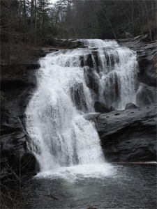
June 21 Falls Branch Falls Hike. This is 3 miles of moderate to difficult terrain. It will include a small water crossing with slick rocks. Wildflowers should be in bloom. A hiking pole or poles is highly recommended. Meet at the Cherohala Welcome Center in Tellico Plains at 9 am or the West Rattlesnake pull-off on the Cherohala Skyway at 10 am. The hike leader is Sue Robinson 423-519-9751. Trip Report: Such a fun day with old and new friends at Falls Branch Falls! Mary Alton, Teresa Greene, Doug Lynch, Lucia Case, and new friends Harry and Cindy joined Hike Leader Sue Robinson and Zoe (and Minnie Moose, too). The flowers were not blooming yet, but the weather was perfect and the water was flowing in the waterfall. And since we didn't get enough, we all made a trek to Huckleberry Knob and then Tellico Grains and Bakery. • Sue Robinson
Cleveland Greenway walks each Wednesday. Contact Leader Jack Callahan for meeting time/place info 423-284-7885.
July 14 Monthly Hiking Club meeting at 6pm. Presentation by Rick Harris of his and Brenda's hiking the Florida Trail. Location is the Etowah Senior center. Mtg Report: The July monthly club meeting was held at the Wesley Memorial United Methodist Church in Etowah, TN. After a really nice array of main courses and many desserts, President James Anderson held a brief business meeting. Following this, Jack Callahan introduced Brenda and Rick Harris, (although no introduction was necessary) who gave an excellent slide presentation on their multiyear section hike of the Florida Trail. The presentation was really informative and covered all sections of the trail with their approach to hiking with minimum overnight camping on the trail. Anyone who is considering hiking any of the Florida Trail should talk with Rick and Brenda to get an idea of logistics and what to expect on the many varied terrains that the trail traverses. We appreciate all of our volunteer speakers who take the time and effort to share their experiences with the club. • Jack Callahan
July 21 Breakfast at Old Fort Restaurant 8:30 am. Jack Callahan is event leader.
Cleveland Greenway walks each Wednesday. Contact Leader Jack Callahan for meeting time/place info 423-284-7885.
No Club meeting scheduled for this month.
August 12-15 Backpacking trip near Franklin, NC. Total distance approximately 28 miles. Trip is rated strenuous. The proposed itinerary includes the following:
Day 1-Shuttle from Nantahala Outdoor Center to Winding Stair Gap on Hwy 64 near Franklin. Hike 4.3 miles from trailhead to Silar Bald Shelter. Hike begins at 3800 feet elevation and the shelter is at 4500 feet so about 700 feet elevation gain.
Day 2-Hike 7.2 miles to Wayah Shelter. Cross Wahah Bald at 5342.
Day 3-Hike 4.7 miles to Cold Spring Shelter at 5000 feet.
Day 4-Hike 11.4 miles to Nantahala Outdoor Center at 1800 feet. During hike that day cross Wesser Bald at 4627 feet. Return to Cleveland.
There is a cost for the shuttle of from $25-40 per person. Also, there are options to add another day to this trip. Buddy Arnold is the leader of this trip so contact him to be added to the list and/or to discuss this or other options at we_arnold@outlook.com or 601-414-3551.
Trip Report: We were blessed with good weather and had a great hike on this portion of the AT in North Carolina. Participating in the hike were Hike Leader Buddy Arnold, James Anderson, Bruce Lee, Darrell Morgan, Al Johnson, Kelly Mott, and Henry Meher. We left our vehicles at the Nantahala Outdoor Center and took a shuttle from there to Winding Stair Gap near Franklin, NC. On the first day we hiked about 4.5 miles to the Siler Bald Shelter. That afternoon we did the short, about 1 mile, but strenuous hike up to Siler Bald. We had beautiful views and nice temperatures. On day 2 we hiked about 8 miles to the Wayah Bald Shelter, a strenuous but scenic hike. Along the way we crossed over Wayah Bald and went up in the fire tower platform for the picture below. We had a brief rain here, with temps in the 60's. Day 3 we hiked about 11 miles to Wesser Bald Shelter 4200', crossing Wesser bald at 4627'. We had clear skies and great views from the fire tower. Day 4 we hiked about 6 miles to the Nantahala Outdoor Center. A lot of downhill, but we had great views along the way. Below is a picture of Henry at a spot called the "Jumpoff" about 2000 feet or so in elevation above the NOC. • Buddy Arnold
August 18 Breakfast at Old Fort Restaurant at 8:30 am. Jack Callahan is the event leader.
August 22 Walk in the Woods. Meet at Johnston Woods trail parking lot just off Hwy 11 S and near the former Bachman Home at 9 am. We will walk the 1.2-mile trail first and then the 2.9-trail for a total of 4.2 miles. Considered easy. Hikers may walk one or both trails as they connect at the parking lot. Hike leader James Anderson 423-715-8824.
August 27 Paw Paw Hike/Hunt along the John Muir Trail. This will be a hike along a section of the John Muir Trail beginning at the Childer's Creek trailhead. It will not be lengthy at only 1mile or so. It is rated easy. Bring lunch and we will eat it on the riverbank. To carpool from Cleveland, meet at Home Depot parking lot on Paul Huff parkway at 9 am. Hike leader is Jack Callahan 423-284-7885. Trip Report: Some 14 club members and visitors and two canines made the trip to Childers Creek trailhead and, after a brief discussion on pawpaws, ventured into several patches to collect the fruit. There was a good crop, but we were possibly one week early for a large number to be ripe; however, there were sufficient ripe ones to give everyone a chance to sample the fruit. As always, there is mixed reaction to the taste. Some loved it; others, not so much. Pawpaw has a custard like texture and tastes like a mango/banana/sweet potato…possibly? You have to try one for yourself. Next, we walked up the John Muir National Recreation Trail (Benton MacKaye Trail) for perhaps a mile or so, then returned to the trailhead. From there, most of the group went to the Forest Service picnic area downriver from Reliance and had watermelon. Then, several more went on to visit the Elliot cabin on Parksville Lake. Maryl was kind enough to invite us to see the family cabin that has been in their family since its construction. It is a nice cabin on a lovely point on the lake. Hopefully there will be further interest in pawpaws and we can try it again next year. • Jack Callahan
Cleveland Greenway walks each Wednesday. Contact Leader Jack Callahan for meeting time/place info 423-284-7885.
No club meeting in September.
September 7-16 Backpacking trip to Three Sister's Wilderness near Bend Oregon. This is a 6-day, 5 night trip hiking about 45 miles in the wilderness. The following itinerary is proposed:
Sept 7-Fly to Bend Oregon and spend the night there.
Sept 8-13 Backpacking on the trail.
Sept 13-Drive to Crater Lake and spend the night there.
Sept 14-15- Explore area including lava flows and museums.
Sept 15-Spend night in motel in Bend.
Sept 16-Fly home.
This trip is currently full with 12 in the group. However, if you would like your name on the list as an alternate in case there are any cancellations, please contact Jack Callahan the hike leader 423-284-7885. The exact dates of the trip depend upon acquiring the necessary wilderness overnight camping permits. The first available date to apply for the permit is April 5, 2022. All attendees will be updated when the exact dates are established.
Trip Report: Nine club members met in Bend, Oregon, for the planned backpacking event to begin on September 8. Those who were in town the morning of the 7th made visits to Dillion Falls on the Deschutes River, the National Forest Lava Butte visitor center and cinder cone, and the Desert High Museum. Another group saw the sights in downtown Bend. To celebrate the event, all gathered for supper in the Old Mill District after a stop in REI for fuel and last-minute supplies. On the 8th, the shuttle picked everyone up at 9 am, and we traveled to the Devil Lake trailhead to begin our hike. Within a few hundred feet we were in the Wilderness area. Our first day gave us views of South Sister and Broken Top, under beautiful blue skies. We were in and out of wooded areas, crossing large meadows and cinder fields. The hike included several miles of the Pacific Crest Trail (PCT). By midafternoon, we arrived at the James Creek shelter, a very old structure on the edge of a nice meadow and close to a clear cold stream. No one used the shelter overnight as it had a bit of a "list" to it. The 9th, we were on the trail by nine, continuing north along James Creek Trail, then the PCT, through mixed woods and meadows. There were numerous nice streams but we had the goal of Sisters Spring in the Obsidian Limited Entry Area. We had good views of Middle Sister and were able to see some of the glaciers on both South and Middle Sister. We passed Obsidian Falls, and arrived at Sisters Spring to find out the area was closed to camping due to restoration restrictions. We continued on another half-mile to camp in a nice meadow. By evening we were beginning to see the smoke plume from the Cedar Fire to our southwest about 60 miles away. Overnight the smoke caught up to us. The 10th, we began hiking in smoke and from time to time, falling ash. The views were very restricted to distant volcanoes. We made the steep climb through the lava fields to the west of North Sister and finally arrived at South Matthieu Lake for our third campsite. This was a restricted area and campers are required to camp in designated areas. With our large group, we almost were able to stay within the designated limits. Overnight the smoke increased and we awoke to tents with a lot of ash on them. The 11th, we were on the trail by 8:30 am, carrying extra water. The next reliable water source was about 10 miles away, based on discussions with hikers we met the day before. After about a mile we entered a previous burn area from 10 to 14 years ago. The smoke had cleared some but was still with us, but did provide shade as we hiked through the burn area. After about six miles, the conditions were beginning to take its toll on a couple of the hikers. Taking advantage of an exit trail, these individuals with a reliable escort left the group and caught a shuttle back to Bend. The remaining six continued on to the water source and set up camp amongst the fallen timber. The name of the stream was Soap Creek, but it was excellent cold clear water. The 12th, we were on the trail again with a very light shower for a short time. The smoke was beginning to clear and we begin to get views of the east side on South and Middle Sister. We exited the burn area and enjoyed views of old growth timber and several small lakes. Another 1000-foot climb and we crossed the pass in the shadow on South Sister and got our first view of Green Lake. This lake is almost a mile long and half a mile wide, and as the name implies, is a beautiful green color due to reflections. It is amazingly clear and ice cold. We got an excellent campsite with great views and enjoyed our last supper of trail food. The 13th, we were on the trail at 8:30 am and made our way to the pickup at the Green Lakes Trailhead. We hiked through beautiful old growth forest and enjoyed numerous waterfalls. Arriving at the trailhead we were greeted by the folks who had left us on the 11th and were treated to ice cold soft drinks. Our shuttle arrived and we were back in Bend before one o'clock. A hot shower and real meat hamburgers and fries were enjoyed. The 14th, two members headed home while the remaining seven drove south to Crater Lake National Park. Driving around the west side of the lake gave us great views, and the smoke was gone. We stayed overnight in the small town of Chiloquin about 25 miles south of the park. The 15th, we reentered the park, visited the lodge, and drove the east side of the lake. By midafternoon we were having a late lunch in Bend, then on to Redmond to a motel close to the airport. The 16th most of us returned home, while one went on to San Francisco and another went to Paris. As of this writing, all are home safely with one still in Paris. Overall, it was a great trip, even with a few days of smoke. We saw country that few will ever get to experience and made great memories. Backpackers included Rick Harris, Benton Harris, Michelle Ritter, Buddy Arnold, Bruce Lee, Jennifer Schroll, Mitchel Schroll, Megan Callahan and Event Leader, Jack Callahan. • Jack Callahan
Sept 20 Black Mountain Trail Hike near Crab Orchard, TN. This hike is approximately 9 miles in length and is considered moderate with 1600 feet of elevation gain. There is a cave, enormous rock formations, a spring house, and a great view at the top. Meet at 9:30 am EST at the McDonald's parking lot in Spring City to arrange to carpool. There is very limited parking available at the trailhead. Sue Robinson is the hike leader. 423-519-9751. CANCELLED
Sept 26 Brush Creek/Boyd Gap Hike. This is a 7-8 mile easy to moderate hike along a trail bordering the Ocoee River above the Whitewater Center. If carpooling from Cleveland, meet at the Hobby Lobby parking lot on Stuart Rd at 9 am. If meeting at trailhead, then be at Boyd Gap trailhead at 10 am. A short car shuttle is required. Bring lunch and plenty of water. The hike leader is James Anderson 423-715-8824.Hike Report: It was a beautiful day to hike in the mountains. A group of 11 of us hiked the seven-plus miles of the Brush Creek Trail. At least two of our group had never hiked with us before. A hint of fall was in the air with cooler temps. A few of the trees were even starting to show some colors. We enjoyed a rest and some lunch on a shaded knoll overlooking the lake that is formed by the dam which is just upstream from where the Ocoee Whitewater Center used to be. • James Anderson
Cleveland Greenway walks each Wednesday. Contact Leader Jack Callahan for meeting time/place info 423-284-7885.
October 1-8 Florida Canoe Trip. This will be a canoe/kayak camping trip to the Suwannee River in the north Florida area. The proposed itinerary is as follows:
October 10 - John Muir Trail work trip - Let's all come out on Monday, October 10, and help maintain our Club's section of the Benton MacKaye Trail (BMT)/John Muir National Recreation Trail, commonly known as the Childers Creek section. It's a beautiful three-mile section that follows the Hiwassee River from Childers Creek to Big Bend. We will meet at the Childers Creek trailhead at 8:30 am to begin the work. The work will mostly consist of brushing out the trail and lopping. So, if you have a gas-powered brush cutter or heavy-duty string trimmer, it would be great if you could bring it. If you don't, the BMTA has some tools and safety equipment like hard hats that we will bring as well and you can use those. Make sure to wear long pants, preferably long sleeves, boots, and insect repellant. If you have your own work gloves, bring those too. Bring plenty of water, snacks, lunch, etc.
We hope to have enough help to have crews start from both ends and then hopefully meet in the middle. It is important that you contact me, James Anderson, at 423-715-8824 to let me know if you plan to join us so we can have enough safety equipment, etc. Remember--Many hands make light work!! To get to the trailhead go to Reliance and cross the bridge headed toward the powerhouse. Just as you go across the railroad tracks, turn right. You will pass a bunch of houses on the river on your right. About a fourth of a mile after you pass these houses you should see a small part of the river on your right. Also, on the right there will be an unmarked gravel driveway. That's the driveway to the trailhead. If you get to the fly-fishing outfitters shop at the next intersection then you've gone too far, so turn around. If you have any other questions, you can text or call me at the number above. James Anderson, Club President Trip Report: A group of seven of us answered the call to do maintenance work on the club's section of the John Muir NRT/Benton MacKaye Trail which begins at Childers Creek trailhead and continues to the Big Bend parking lot. The group, which consisted of Rick Harris, Brenda Harris, Will Dostie, Buddy Arnold, Keith Mertz, Mary Alton, and James Anderson, was able to brush out about 2.5 miles of the trail. Also, eight logs were sawn and removed from the trail. At the end of the work day, we enjoyed cold drinks before heading home. MANY MANY THANKS to those who volunteered their time to make this happen! Your work is greatly appreciated. • James Anderson
October 13 Monthly hiking club meeting at 6 pm. For the program Mary Alton will give a presentation on fly fishing and insect baits on the Hiwassee River. The meeting will be held at the Charleston City Park. Mtg Report:
The club met at Charleston city park and enjoyed a potluck supper and a plethora of great desserts. After a short business meeting by club president James Anderson, club member Mary Alton gave us a very informative introduction into four of the main food sources for trout in the Hiwassee River. Mary had collected samples of the different insects and had them in their various stages of their life cycles. Some were so tiny a magnifying glass was required to get a good look at them. She explained how they go through their life cycle and when the trout are most likely feed on them in their different stages. She also emphasized that when a certain insect is molting, that is the only thing trout will feed on. A presentation with the exact imitation fly is the only way to catch the trout. Mary also had the flies that the experienced fisherpersons use on these occasions. It was a great presentation and we are fortunate to have such a knowledgeable person in the club. Mary also mentioned that the local chapter of Trout Unlimited that she belongs to has numerous events that are open to the public to teach interested beginners the art of fly fishing. A special thanks to Mary for all her effort to make this presentation a memorable one. • Jack Callahan
October 16-20 Big South Fork Car Camp. We will be group camping at group campsite E-1 at Bandy Creek near Oneida, TN. The sites do not have electricity but campers, RVs, and tents are fine. They have a very nice and heated bathhouse with hot showers. They also have a screened picnic pavilion with a fireplace where meals are eaten. This year we will be again doing group dinners where a person or persons cook a meal for everyone at night. A signup sheet and email will be circulated prior to the event for planning purposes. Trip Report: This year was the seventh year the Club has done a campout at Big South Fork. We had 14 campers participate in the hiking, food, and fellowship. The fire in the fireplace felt especially good this year as nighttime temps were in the upper 20s and low 30s and with daytime temps in the 40s and 50s. This year was also a good year for food as we went back to having group meals for breakfast and dinner. Many thanks to those of you who planned and provided those wonderful meals!!!! Our hikes this year included the obligatory trip to the Twin Arches, as well as a trail in Pickett State Park, a hike out to the western overlook, walks around the Bandy campground, a hike on the John Litten/General Slaven Farm Loop, and the Oscar Blevins Farm Loop. We hope you enjoy the various pictures from the campout. • James Anderson
October 27 Fiery Gizzard Hike. We will hike the rim above Foster Falls to get some wonderful views of the fall color in the valley below. The hike will be led by Ranger Randy Hedgepath, who has great knowledge of the area and the state park system. To carpool from Cleveland, meet at the Park and Ride commuter parking on Georgetown Road next to the Mapco station by I-75 Exit 25. We will leave the parking lot at 8:45 am EDT. We will meet at the Visitor Center, 11745 Hwy 41, Monteagle, TN, at 9:30 am CDT for an overview of the hike before we begin. The hike will be around five miles and is considered moderate. Bring a lunch and water to eat on the trail at an overlook. After the hike, we will stop by the Dutch Maid Bakery in Tracy City for some take-home treats. Many thanks to Marrie Lasater for her work in organizing this event. If you plan to join us on this hike you must register with Jack Callahan by calling or texting at 423-284-7885.. Trip Report: Twelve club members and two visitors met at the South Cumberland State Park Visitor Center on Highway 41. There we had a brief orientation with State Naturalist Randy Hedgepath and proceeded to the trailhead parking at Foster Falls. We began our hike by viewing the falls area from the overlook, then proceeded around the rim of the gorge across the top of the falls and past several overlooks to our lunch spot, a great rock overlook of the large gorge. After lunch, we hiked another mile to another overlook for more spectacular views and the great fall colors. From there we returned to the trailhead and thanked Randy for a great hike and the many great stories and nature items he highlighted along the way. Then many of us went on to the Dutch Maid Bakery in Tracy City to view the great bakery items there. This is always a wonderful stop to finish up a hike, with a wide assortment of cookies, pies, breads, and other "healthy" items. A special thanks to Marrie Lasater for her coordination with Randy to organize this event. We had great weather and a wonderful time. Hikers included Cindy and Harry Stimmell, Maryl Elliott, Leslie Auriemmo, Clare and Ed Sullivan, Jennifer Schroll, Lettie and Jim Whisman, Randy Hedgepath, Hike Leaders Marrie Lasater and Jack Callahan, and two visitors, hopefully to be members soon, Pat Whitmore and Connie Ocepek. • Jack Callahan
Cleveland Greenway walks each Wednesday. Contact Leader Jack Callahan for meeting time/place info 423-284-7885.
November 1-4 AT BACKPACK NEAR FRANKLIN, NC
I am recommending the itinerary for the hiking trip scheduled for Nov 1-4 (Big Creek Loop and Day Hikes) be changed to a backpack on the AT near Franklin, NC. The first day we would drive to the Standing Indian Campground off Hwy 64 toward Franklin. We will park at the Backcountry Info Center near there. The hike is rated strenuous due to elevation gains on part of the hike, but much of the hike would be moderate. In the October newsletter is a map of the area which includes a profile of the AT section at the bottom. (SEE MAP NEXT PAGE.) There are a number of scenic views on the hike. The distance hiked will be about 25 miles. There are shelters along the hike, but they are smaller capacity (6 to 8), so it will be required to bring tents. The hike will be limited to eight. So far, four have expressed interest, so four more spots are available.
• Nov. 1, Day 1, Drive to Murphy NC, take Hwy 64 Toward Franklin to USFS Road 71, then to Standing Indian Campground. Meet at Backcountry Info at noon. Hike about 3 miles to Long Branch Shelter via Blackwell Gap Trail and then AT.
• Nov. 2, Day 2, Hike 8.9 miles to Carter Gap Shelter on AT.
• Nov. 3, Day 3, Hike 7.6 miles to Standing Indian Shelter.
• Nov. 4, Day 4, Hike 4.5 miles back to Backcountry Info Center via AT and Kimsey Creek trail.
Contact Hike Leader Buddy Arnold at we_arnold@outlook.com or 601-414-3551 cell.
November 10 Hiking Club Monthly meeting 6 pm. The program will be a slide show presentation of the Three Sisters Wilderness Backpacking Trip by Jack, Jennifer, and Rick. The meeting will be held at the Etowah Senior Center. Mtg Report: The club met at Etowah Senior Center and soon lit into the delicious potluck meal. Afterward, James Anderson conducted the business part of the meeting which included information on next month's Christmas party and hikes. Also, Lettie Whisman told us about her upcoming book. Then, Jack Callahan and Jennifer Schroll, along with Rick Harris, gave us a slideshow presentation on their recent backpacking trip to Three Sisters Wilderness in Oregon. We saw spectacular scenery and heard about the different geologic formations they backpacked through on their multi-day trip. The photos of the ashy skies from the wildfires were harrowing but beautiful. We appreciate that they shared their experience with us. • Judy Price
November 14 Hike to the Narrows on the Hiwassee River. This is a 4.5-mile moderate hike along the Hiwassee River above the Powerhouse. Bring water, lunch/snack, personal first-aide kit, rain gear,
hiking poles, bug repellant, and sunscreen. Learn about penstocks and the powerhouse. Meet at Reliance Fly and Tackle Shop at 9 am. Hike leaders are Claire and Ed Sullivan 404-849-0872, clare7982@gmail.com. Trip Report: Seven CHC hikers enjoyed a beautiful hike to The Narrows on the Hiwassee River in Reliance. Three of the hikers had never been to this fun and interesting location. We started the hike in freezing weather and enjoyed seeing frost flowers and some ice at The Narrows. Jack Callahan was along so we enjoyed learning about puffballs and other amazing fungi. We tried opening persimmon seeds to get nature's forecast for Winter 2023 but quickly learned that opening the seeds is not an easy task. Once at The Narrows, we dropped our packs and went exploring. Three hikers actually made it to the "Big Hole." The sky was sunny, and the day was perfect for hiking! Enjoying this hike were Leslie Auriemmo, Lynne McPhail, Adrianna Hernaudez, Sue Robinson, Jack Callahan, plus Hike Leaders Ed and Clare Sullivan. • Clare Sullivan
November 17 Breakfast at Old Fort Restaurant. Jack Callahan event leader.
November 26 Linda Davis Memorial Cleveland Greenway Walk. Traditional after Thanksgiving walk. Meet at the Greenway Pavillion and parking area on Raider Drive. Walk leader is Randy Morris 423-650-0485. Trip Report: On this cool crisp morning, four members of the club walked a portion of the Cleveland/Bradley County Greenway in the annual Linda Davis Memorial After-Thanksgiving Walk. Linda was an avid member of our club and had led a similar hike on the Chattanooga Riverwalk before her untimely passing in 2008. In August 2008, the club decided to name a Saturday after Thanksgiving Walk in her honor and it has been held continuously ever since; this year marked the 15th annual event. We walked from the pavilion at Raider Drive north to the trail's northern terminus and back to our vehicles. We enjoyed the walk, great conversation and memories of Linda. Participants were James Anderson, Carol Guhne, Judy Price, and Walk Leader Randy Morris. • Randy Morris
November 28 Walk in the Woods. Meet at Johnston Woods trail parking lot just off Hwy 11 S and near the former Bachman Home at 10 am. We will walk the 1.2-mile trail first and then the 2.9-trail for a total of 4.2 miles. Considered easy. Hikers may walk one or both trails as they connect at the parking lot. Hike leader James Anderson 423-715-8824.
Cleveland Greenway walks each Wednesday. Contact Leader Jack Callahan for meeting time/place info 423-284-7885.
December 10 Hiking Club Annual Christmas Party with new officer installation and dirty Santa gift exchange. Mark your calendars for our annual Christmas Party on Saturday, December 10, 2022, at 6:30 pm. It will be at Bradley Square Mall in Cleveland at the Heat and Eat location. Our own Jennifer Schroll will cater our event. More details will be announced. Thank you to the committee of ladies who met to begin the planning process. We had a great time.
December 17 Dutch Settlement Hike. This is a 5-mile hike where most of it is bushwhacking beginning at Pace Gap and following an old access route to the settlement. It is considered moderate. Meet at Thunder Rock Campground at 9 am to carpool to trailhead. To carpool from Cleveland contact Jack Callahan the hike leader 423-284-7885. Trip Report: A lively group of 14 club members and friends met at TVA Sugarloaf picnic area and made the drive to Pace Gap to begin the hike to the old Dutch Settlement. The area was settled in the 1840s by a small number of German, Swiss and Dutch families. The inhabitants gradually concurred the small valley and cleared land, planted orchards and grew gardens, and were self-sufficient. Their children walked about two miles through the woods to a school at the Sylco settlement. Over time, the families began to move out and the Forest Service purchased the land in the 1930s. The hike followed the original wagon road trace to the site of the former Beckler home, one of the longtime residents. All that remains are some of the corner stones of the log home, as well as chimney stones and evidence of the root cellar. After a discussion of the history and a lunch in the field surrounding the homesite, the group made their way back up the abandoned wagon road to Pace Gap. From here, the group retraced their route and made a stop at the former site of CCC Camp 1452 in the Sylco area. With GPS coordinates and references from a 1934 USGS topo map, the group found the remains of the dam on Sylco Creek. This dam was built by the enrollees for a "swimming hole" to enjoy in their limited free time. There are other interesting remains in the Sylco area which will be explored on another trip. Hikers making the trip included Judy Price, Jennifer Schroll, Charlene Sudore, Judy Norton, Evelin Yarns, Doug Yarns, Clare Sullivan, James Anderson, Cindy Stimmel, Harry Stimmel, Gayle Drummond, James Drummond, Clayton Webster, and Event Leader Jack Callahan. • Jack Callahan
December 19 Starr Mountain Hike. Out and back 6.5-7.0-mile hike from Gee Creek to the top of Star Mountain. In the winter the views to the west are nice. The trail is rocky and not well-maintained, so I rate it as strenuous. Wear sturdy boots and bring hiking poles along with water and food. Meet at Piggly Wiggly Food Store in Charleston at 9 am or the trailhead at Gee Creek at 9:30 am. Hike leader is James Anderson 423-715-8824. Trip Report: It was a quite chilly day for the hike up Starr Mountain. Hike Leader James Anderson and Don Bennett completed the 6.5 mile out-and-back hike. The first mile or so of the trail was in good shape but the remainder was in great need of maintenance. A number of blowdowns, briar, and undergrowth encroachment, as well as the trail tread disappearing, were just a few of the challenges facing the hikers. Although it was challenging, the pair made it to the top where they had lunch, rested a bit, and enjoyed the view. Along the way, they noticed an interesting "sapcicle" oozing from a downed tree! • James Anderson
December 22 Breakfast at Old Fort Restaurant. Jack Callahan is event leader.
DECEMBER 26, 2022 SUNDAY CHATTANOOGA TN ENTERPRISE SOUTH NATURE PARK - We will leisurely hike up to four miles on the easy-to-moderate hiking trails beginning at the Poe Run parking. Contact Hike Leader Judy Price at cherokeehikingclub@gmail.com for information on meetup time and place. Trip Report: Five hikers--visitors Kathy Thelen and Tim S., and members Mitchell Schroll, Jennifer Schroll, and Hike Leader Judy Price--met up at the Enterprise South Nature Park Visitor Center to begin a four-mile hike on the nature trails. Projected snow flurries never materialized while we were hiking. We started on Upper Poe Run and hiked to the hidden lake, passing bunkers where TNT had been stored when the site was the Volunteer Army Ammunition Plant. We took a short break at the lake. The lake was frozen, so Jennifer bravely walked out to "test the waters" (pun intended). Too bad we forgot our ice skates. We then returned on Deer Hollow Trail and Poe Run to the trailhead. We appreciate our visitors joining us! • Judy Price
JANUARY 1, 2023 SUNDAY - FENTON FOREST ON BAUXITE RIDGE - COLLEGEDALE TN -We will leisurely hike the two-mile, easy picturesque Sabbath Trail loop and then, if we want to continue hiking, we will hike the one-mile Oak Hole Lane back to the main trailhead junction. There is a short steep uphill at the beginning to the trailhead junction (and downhill on the way back). A trailhead restroom facility was being built recently so we shall see if it's finished! Contact Hike Leader Judy Price at cherokeehikingclub@gmail.com for information on meetup time and place.
JANUARY 5, 2023 THURSDAY - WHITE OAK MOUNTAIN TRAILS COLLEGEDALE TN - We will leisurely hike approximately three easy-to-moderate miles from Trailhead #1. Anyone who wants to continue hiking on the many trails is free to do so but will need to provide their own transportation. There are restroom facilities at the trailhead (if they are unlocked). Contact Hike Leader Judy Price at cherokeehikingclub@gmail.com for information on meetup time and place.
JANUARY 8, 2023 SUNDAY 2 PM -
ANNUAL PLANNING MEETING - ETOWAH TN SENIOR CENTER -
Do you want to lead a hike or event? If so, bring your ideas to our annual planning meeting! Be sure to include all details in writing to turn in including date, time, description, hike difficulty, entrance fees, etc. If you cannot attend, you may email the information to cherokeehikingclub@gmail.com. See you there!
JANUARY 28, 2023 SATURDAY - CHILDERS CREEK SECTION TRAIL MAINTENANCE - BIG BEND TRAILHEAD RELIANCE TN - Calling all Cherokee Hiking Club Volunteers! Hopefully all of you remember that our Club has officially adopted the section of the Benton MacKaye Trail (BMT)/John Muir NRT known as the Childers Creek section to help maintain. This section is in real need of some treadwork restoration along the part of the trail where it goes around a rock bluff area about halfway in. I'm very pleased to announce that we have a commitment from the larger BMTA maintenance group to help us with that work. With weather permitting, we plan to do this work on Saturday, January 28. So, I hope that a number of you will put this important date on your calendar and show up to help out. Presently, the plans are to meet at the Big Bend parking area on the Hiwassee River to begin our workday and to have some food afterward. I will let you know more later about the specific meeting time, etc. Again, please put this on your calendar and come help us as this is a Club