
Cherokee Hiking Club
198 Crews Drive, Benton, TN 37307
Trail
Maintenance
Gravelstand Top Trail
Tuesday, September 2, 2008
Wednesday, October 29, 2008
Tuesday, September 2, 2008: I [Ken Jones] decided to spend the day catching up on some sign issues for both Districts. Steve Biatowas was kind enough to give me some motorcycle decals for the carsonite posts, so I set out to put them to good use. I started the day by reviewing the Trails Initiative documents on the computer, and verified that Gravelstand Top Motorcycle Trail is not currently slated to be abandoned.
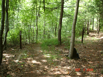
Tellico District: I drove out the Miller Cemetery Road to the Gravelstand Top Motorcycle Trailhead and added a motorcycle decal to the carsonite post. I then walked about the first half (1 1/4 miles) of the trail to check on the conditions. The part that I walked was in good shape with only a handful of blowdowns to clear. However, where I turned around on the top of the ridge, I could see dozens of pines across the trail. It looked like the rest of the trail is in similar condition, so Tom Coppinger and the other volunteers will have plenty of work when they get chainsaw certified.
I then drove to the point where Warriors Passage Trail crosses the Bald River Road to remove the Trail Closed sign. The last time I attempted this job, the yellow jackets got me. I used a rock bar to dig down about a foot deep around the post, but still could not pull it out. I wrapped a tow strap around the post and pulled on it with my truck in 4WD. The metal post bent over to the ground, then broke off below ground level. I then back filled the hole to cover over the broken piece of metal.
Next I drove up toward Basin Gap and found that the other trailhead sign post for Gravelstand Top Motorcycle Trail was correctly marked.Ocoee District: I drove up the Buck Bald Road to the point where the Unicoi Mountain Motorcycle Trail (#82) / BMT (#2) cross the road. I went southbound toward Highway 68 to install two new carsonite posts to mark the intersection where the two trails split. When I reached the intersection, I found there was an existing problem. A broken off post with #82 and a right turn arrow was propped up against a tree. In that position, it made the BMT look like the motorcycle trail. I have attached a picture taken from the intersection showing the end results of my work to correct the problem.
Since most of my work was in the Tellico District, I will count all of my time for the day on Tellico –
Travel Hours = 1.5 Work Hours =5 Total = 6.5
- Rick Harris and Tom Coppinger braved the cold weather (22 degrees) to check the condition of the ~3.5 mile long Gravelstand Top Motorcycle Trail in the Tellico Ranger District in anticipation of opening the trail back up to motorcycles. The trail was closed in 1993 when fires in the area done by an arsonist caused much damage to the trail at the time and in the years since due to dead trees falling over the trail and scrub brush filling in the gaps. They drove to the end of the trail near Basin Gap to drop off a car, then returned to the Miller Cemetery end of the trail to begin the hike. The first 1.2 miles were OK with only 4 trees over the trail as it ascended several hundred feet to the ridgeline. Then they entered the burned over area. The next 0.4 miles was almost impassible due to downed trees and thick shrubs. The next mile and a half again were not too bad, but several trees were over the trail. Then the final half mile or so again was nearly impassible due to the fires of the past. But the views were exceptional in this area because of the unobstructed views of Waucheesi Mountain and the surrounding area.Tom plans to take this information back to the motorcyclists to determine their interest and willingness to do the large amount of work which would be needed to open up this trail. Several of the motorcyclists recently took the USFS chain saw class in anticipation of this project. Also, Tom will approach the Tellico Ranger District about other possible help in clearing the heavily damaged areas of the downed trees by heavy machinery. Report is that the ranger district cannot help in this respect due to higher priorities.It took of 3.5 hours to walk the 3.5 mile long trail. We did not do any chain sawing due to being dead tired after climbing over tree trunks for 3.5 hours. A GPS map of the trail can be examined by going to this link.Here is our volunteer time for the work trip:
Rick Harris, 4 work hours, 2 travel hour, total 5 hours
Tom Coppinger, 4 work hours, 3 travel hours, total 6 hours
Contact the Webmaster