Cherokee Hiking Club
198 Crews Drive, Benton, TN 37307
![]()
Benton MacKaye Trail
Trail
Maintenance
Benton MacKaye Trail -
Section 19
Farr Gap to Smoky Mountains
April 25,
2009
May 31, 2009
January 19, 2010
March 5-7, 2010
June 30, 2010
July 18, 2010
August 29, 2010
September 21, 2010
October 1, 2010
Saturday, October 16, 2010
Saturday, December 11, 2010
March 8, 2011
March 16, 2011
May 21, 2011
May
27, 2011
July
6, 2011
July 16-17, 2011
October 11, 2011
December 10, 2011
Monday, April 9, 2012
July
19, 2012
August 1, 2012
Saturday, October 6, 2012
This section of the Benton MacKaye Trail is from Farr Gap in the Citico Creek Wilderness to Deals Gap at the border to the Smoky Mountains.
April, 25, 2009: We cleared BMT Section 19c of trees across the trail and brushed out the trail from the Little T to the top of the ridgeline, about a half mile from where the trail joins the Alcoa service road. Four hardy workers participated in the work trip: Rick Harris, Ken Jones and Joy Benn. Joy lives just minutes from the trailhead. Rick Evans met us at the trailhead by the dam, but could not work since he has caring for his grandchildren while his wife cooked up food with ramps for the Ramps Festival. Thus we have a little work left to do, but we can take care of this easily on another day. The trail is in excellent condition except for a few short areas which need to be re-side-hilled. There was one huge tree which fell across the trail at the top of the ridge. We cleared what we could and routed the trail under the trunk of the tree. We need to go back and reroute the trail around the base of this humongous hardwood for safety of the hikers. This would be easy to do with a little brush cutting. Workers hours are as follows:
Name
Travel Hours
Work Hours
Totals
Rick Harris
2.5 6.5
9.0
Joy Benn
0.5 5.5
6.0
Richard Evans
1.5 0
1.5
Ken Jones
3.0 6.5
9.5
Totals
7.5
18.5
26.0
May 31, 2009: BMT Walkthrough on Section 19. Randy Morris & James Anderson. Report attached.
Tuesday, January 19, 2010: BMT Section 19b - Tapoco to Slickrock Creek - Ernie Engman responded to a report of a large
lowdown on his section just north of the Slickrock Creek crossing. He cleared this almost completely and cleared a few other more minor blowdowns and brush. He left a huge leaner over the trail and a couple other blowdowns closer to US129 which a chain saw could be used on. "That blow-down was pretty bad. I got about 85% of it out by myself yesterday. The other 15% is a hickory that
was beyond the tools I was carrying and two logs that need to be cut back next time I go up there. I’ve also got 3 leaners out there. 2 of them were in areas that a chainsaw could be used so I bypassed them and saved my time to work that big blow down. One is a massive poplar that was beyond my solo ability and is in a difficult position to cut." Volunteer hours:
March 5-7, 2010: BMT Sections 19A & 19B - Farr Gap to the Little T - Ernie Engman and his son Matthew worked on this section of the trail as a backpacking trip and ran into Tipi Walter who helped out as well. They cleared brush and 16 blowdowns from the trail and cleared trash out of fire rings. They got to within 1.1 miles of Farr Gap. By report from Tipi, who came down that route, there are a few blowdowns, including one major one in the remaining segment and this segment needs brushing out as well. Other needed work includes touching up blazes in sections outside of the wilderness and a new sign is needed at one point. Also about 100 feet of sidehilling is needed on the Ike Branch Trail. Volunteer hours are as follows:
Name
Travel Hours
Work Hours
Totals
Ernie Engman
2.0 9.0
11.0
Name
Travel Hours
Work Hours
Totals
Ernie Engman 2 16 18 Matthew Engman 2 16 18 Tipi Walter
0 7.5
7.5
TOTALS 4 39.5 43.5 June 30, 2010: BMT Section 19b - Little T to Slickrock Creek - Brandon Gardner and Dick Evans went up on 19b today and sawed out the downfalls, etc, between the trailhead and the Wilderness border. Trail is totally clear and walkable now.
Name
Travel Hours
Work Hours
Totals
Dick Evans 2 3 5 Brandon Gardner 2 3 5 TOTALS 4 6 10 July 18, 2010: BMT Section 19b - Little T to Slickrock Creek - Now that the Dragon is clear Ernie and Matthew got down there to their section and did some brush work. It actually looked pretty good considering. It was VERY hot out there. Ernie only went out for brush work and some light cutting if needed so he wasn’t prepared for the big blow down he found. But it is easy to get over or around, so he will get back out on it when he has some free time and hopefully it is also a little cooler. They did clear two smaller logs, though.
BMT Section 19a - Farr Gap to Stiffknee Gap - 6 of us brushed out this very overgrown section of the BMT from Farr Gap to Stiffknee Gap using swingblades and loppers. We also cut about 8 trees off the trail with handsaws or crosscut saw. This section is now in great shape. There is a root ball in the trail about 0.2 miles from Farr Gap which will have to be removed in the future. Also, some treadwork is needed in places. Volunteer hours are below:
Name
Travel Hours
Work Hours
Totals
Ernie Engman 3 9 12 Matthew Engman 3 9 12 TOTALS 6 18 24
Name
Travel Hours
Work Hours
Totals
Doug McPherson 7 4 11 Susan Harris 7 4 11 Tom Smith 2 4 6 Larry Dunn 2 4 6 Richard Sullivan 3 4 7 Rick Harris 2 4 6 TOTALS 23 24 47 September 21, 2010: BMT Section 19b - Little T to Slickrock Creek Trail - Ernie Engman cleared two trees near the intersection of the Ike Branch Trail and Slickrock Creek Trail today.
Name
Travel Hours
Work Hours
Totals
Ernie Engman 2.5 4 6.5 Friday, October 1, 2010: BMT Section 19a - Farr Gap to Slickrock Creek - On Friday October 1, Jeff Hunter with Tennessee Wild led 12 volunteers from Great Old Broads for Wilderness on a trail maintenance trip in the Tellico Ranger District. These women were from all across the country, and came to Tennessee to hike, participate in a service project, and learn about the areas proposed for new wilderness designation. The work effort was focused on the Stiffknee Trail tread. Working with pulaskis and a fire rake, the volunteers widened the trail, corrected the outslope, and put the trail back in it's original location. Approximately a half mile of trail was worked on. The area could use another work trip to continue this effort. A half dozen volunteers could finish the work in a half day.
13 volunteers at 7 hours (9:30 am - 4:30 pm) = 91 total volunteer hours.Saturday, October 16, 2010: BMT Section 19a - Farr Gap to Slickrock Creek - Five trail volunteers completed work on the Stiffknee Trail. Last month for the monthly TN/NC BMT Work Trip we cleared and logged out this section from Farr Gap to Stiffknee Gap. This month we brushed out and logged the trail the rest of the way to Slickrock Creek. The bottom mile of the trail still needs some work on brush removal. We met several people hiking or camping along the trail this beautiful fall weekend. Afterwards, we ate supper at the Tellico Outpost. Volunteer hours are below:
Name
Travel Hours
Work Hours
Totals
Rick Harris 2 7 9 Ken Jones 3 7 10 Bill Lundin 3.5 7 10.5 Jeff Hunter 4 7 11 Lara Winner 4 7 11 TOTALS 16.5 35 51.5 Saturday, December 11, 2010: BMT Section 19c - Little T to Deals Gap - Nine trail volunteers came out on this chilly cloudy day
to log and brush out this section of the BMT that had been in part involved in a forest fire several months ago. One crew came in via the Alcoa Access Road from Deals Gap and the other crew came up from the Cheoah Dam on the Little Tennessee River. With chain saws and gas powered brush cutters, the work was accomplished quickly and the work was all done by 1PM. We thus ate lunch at the parking lot above the dam, then headed home. We also searched out a possible route to bypass the very steep section by the rock ledges and placed a few flags to potentially mark a new switchback route. We think we found a good route, but will have George Owen and Walt Cook check it out. Dick Evans will go back in the next few months and touch up the blazes. We may make a weeklong work trip this spring or summer to build the switchback, if approved by the BMTA Board and Alcoa, as well as rework a lot of the rest of the tread which is becoming very narrow and somewhat dangerous along the steep hillside. Volunteer hours are below:
Name
Travel Hours
Work Hours
Totals
Rick Harris 2.5 4 6.5 Ken Jones 3.5 4 7.5 Larry Dunn 3.5 4 7.5 Marty Dominy 5.0 3 8 Tom Smith 4.0 4 8 Dick Evans 2.0 4 6 Bill Lundin 4.5 4 8.5 Vic Frelund 3.0 4 7 Ernie Engman 2.0 4 6 TOTALS 30 35 65 March 8, 2011: BMT Section 19c - Tapoco Section - On a beautiful day in early March, five stalwart folks set out on a walk-through evaluation of the Tapoco Section of the BMT. The Tapoco Section, on the Tennessee/North Carolina line immediately west of the Great Smoky Mountains National Park, is probably one of the more remote and least hiked sections of the entire Benton MacKaye Trail. The land is owned by Alcoa Power Generating Division of Alcoa Corporate, but they generously have given a right of way passage thru their property for connecting the Trail between Slickrock Creek in the Joyce Kilmer Slickrock Wilderness with the National Park.
The first nearly three miles is on old gravel road. At one time, parts of this were a toll road between Robbinsville, NC, and Knoxville, TN,and was used by folks bringing their produce and animals to the markets in Tennessee. Local folks tell stories of herding turkeys north thru the woods to reach the Buyers in the "Big City". While we found (as expected) that the blazes were faded, this part of the Trail is impossible to lose, as the gravel road is unmistakable and a very pleasnt walk. We thought we were too early for Spring wildflowers, but sharp-eyed Kim found the first Trillium of the season right by the Trail. Later in the Spring, the wildflower display is fantastic. One large log had fallen across the road, which was easily passed on foot, and will be removed later this season.
At a little less than three miles, the Trail changes totally. It cuts up a slope, through a pine forest devastated by the Pine Bark Beetle a few years ago, with lots of blowdowns and dead trees, but the Trail was clear. At the ridge, the Trail rejoins part of the original Appalachian Trail, routed here until 1948, when it was relocated to cross over Fontana Dam. This part of the Trail is about 1.7 miles in length, and we found it passable except in one location, scouted last year, which will need chainsaw work and tread work to restore it to full functionality. A wild fire went through this area last year, but yellow flags keep the hiker on course thru this area, and the forest is recovering nicely in the area. A bulldozer was brought in to fight the fire, and the dozer followed the Trail for 100 yards or so, but the route is easy to follow. In winter, there are very nice views into the Joyce Kilmer Slickrock Wilderness, and you can see the Fodderstack Ridge area where the BMT follows the edge of the Citico Creek Wilderness to the Cherohala Skyway. The Trail then passes under a power line and descends fairly steeply to the Cheoah Dam.
Overall, there is only one area which needs work, but a warm Spring will bring out vines in profusion, so this section will need a good brush cutting late this Spring. We will continue to use yellow flagging tape to indicate the Trail through the burn area until trees grow large enough for proper blazes. Signs are posted to that effect.
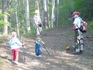
Participants in photo, Dick Evans, Kim Hainge, Margaret Evans, Lois and Wendi Thomas. Travel Time -10 hours, Work Time -15 hours.March 16, 2011: BMT Section 19b - Slickrock Creek Area - Ernie Engman, section maintainer, went out on this beautiful spring day to work on his section. He cleared several blowdowns and brush and repainted several blazes. He left one very large hemlock outside of wilderness which will have to be cut out with chainsaw. Volunteer hours:
Ernie Engman, travel time 2.5 hours, work time 6.5 hours, total 9 hours
May 20-21, 2011 - BMT Section 19b - Slickrock Creek Area - Ernie Engman and his sons (Matthew and William) worked on logging
out their section over two days and did not get the job completed. They worked about 6.5 hours on May 20 and another 2.5 hours on May 22. There are some nasty blow downs and some erosion issues. With all that work they only made it in 1.5 miles on their section and they still need to go back
at a later date and finish some of what they started. The hemlock noted of a previous trip had 5 new trees on top of it right on the trail. They cleared out 4 of them and limbed out the 5th so a chainsaw can get to it. They almost finished clearing another one that also took a bunch of trail with it. They were able to fill back in the hole for the trail, but after getting that one half cut out (4 hours of the total work were on this one blow down) it is passable but needs a chainsaw to finish it. Ernie has the contact information for Jeremy and Scott with the USFS for when he can go back in with them and finish out those two. The link is for the video of the hemlock involved blow down after they cleared it out some. http://www.youtube.com/watch?v=m5rIJTARoGQ
Name
Travel Hours
Work Hours
Totals
Ernie Engman 3.5 9 12.5 Matthew Engman 3.5 9 12.5 William Engman
3.5 9 12.5 TOTALS 10.5 27 37.5 May 27, 2011 - BMT Section 19b - Slickrock Creek to Little T - Ernie Engman (section maintainer)
got Rick Harris and Dick Evans out to help him cut some big logs off his section with chainsaw. We accomplished the job, but Rick had to let his chainsaw cool down a couple of times. After cutting some trees off a huge hemlock, we then cut the hemlock itself, (see picture).
Name
Travel Hours
Work Hours
Totals
Ernie Engman 3.5 4 7.5 Rick Harris 4 4 8 Dick Evans
1 4 5 TOTALS 8.5 12 20.5 July 6, 2011 - BMT Section 19b - Ernie Engman and his son William worked on their section repairing tread and removing two blowdowns.
Name
Travel Hours
Work Hours
Totals
Ernie Engman 2 2.5 4.5 William Engman
2 2.5 4.5 TOTALS 4 5 9 July 16-17, 2011 - BMT Section 19b - Ernie Engman and his son William cleared 8 blowdowns and lots of vegitation off their section near Slcikrock Creek on an overniter.
Tuesday, October 25, 2011 - BMT Section 19a - Farr Gap to Stiffknee Gap - The AHS Volunteer Vacation crew tackled this 1 mile section of trail today along with a few BMTA volunteers. We brushed and logged out this section in the gentle continuous rain and put up a new wilderness sign as well as a new BMT sign at Stiffknee Gap. We finished early due to the continuous rain. We did not get to pull off the side of the hill to two rootballs because of the rain and slipperiness. Next time for those. We also did not do any treadwork except for a short section which had been washed out in a sidehill drainage. This section of trail looks really good now and sports new signs.
Name
Travel Hours
Work Hours
Totals
Ernie Engman 2 9 11 William Engman
2 9 11 TOTALS 4 18 22 December 10, 2011 - BMT Section 19b - Little T to Slickrock Creek - Ernie Engman (section maintainer) and his two sons got out to work on their section, clearing 11 trees and reworking about 20 yards of tread.
Name
Travel Hours
Work Hours
Totals
Rick Harris
0.5
5.5
6
Travis Schwartzer - USFS
(5.5)
(5.5)
Larry Dunn 2
5.5
7.5
Rick Foster 1.5 5.5 7 Eric Randall - VV 5.5 5.5 Mark Harrold - VV 5.5 5.5 Sarah Slover - VV 5.5 5.5 Betty Gill - VV 5.5 5.5 John Carmichael - VV 5.5 5.5 Tina Stambaugh - VV 5.5 5.5 Tina Temple - VV 5.5 5.5 Bill Twitty - VV 5.5 5.5 Totals
4
60.5
64.5
Name
Travel Hours
Work Hours
Totals
Ernie Engman 2.5 4 6.5 Matthew Engman 2.5 4 6.5 William Engman
2.5 4 6.5 TOTALS 7.5 12 19.5 Monday, April 9, 2012 - BMT Section 19c - Deals Gap to Cheoah Dam - On a beautiful morning in April, Dick Evans and Doug Stoeppelwerth headed up the BMT from Cheoah Dam, to remove some of the blow downs blocking the Trail. We had seen them during the walk thru last week, and they were also reported by Bill Lundin. This area, owned by Alcoa Power Generating, Inc., is the connecting section between the Joyce Kilmer Slickrock Wilderness on the west and the Great Smoky Mountains National Park to the east. Although short, this section is steeply uphill from the dam, and actually in part is on the original Appalachian Trail, abandoned in 1948 when the AT was rerouted over Fontana Dam.
This section suffered a wildfire last year, and, although not devastating, it certainly destroyed many of the smaller trees and weakened others. The particular tree we addressed had fallen lengthwise on the trail, totally blocking passage. It was complicated by having several smaller "springpole" trees bent underneath the larger one, so reducing it was an "interesting exercise." Doug's expertise as a former Trail Maintainer in the Park was crucial in removing this blockage safely. In addition to the major tree, we also removed many other fallen trees along the route and trimmed a good amount of brush, but we do need to do further trimming to eliminate foliage from the trail width. The good news is that the fire opened up the views of the Joyce Kilmer Wilderness a good deal. The trail is now passable with a pack, and we certainly recommend it as a day trip from the Cheaoh Dam area (plenty of parking in that area and at the Cheoah Bridge, just down hill). Although the trail comes out at Deals Gap, the Tennessee/North Carolina State Line, we really do not recommend parking there due to traffic considerations.
Volunteer Hours
Doug Stoeppelwerth - 4 hours travel, 4 hours work.
Dick Evans - 1.5 hours travel, 4 hours work.July 19, 2012: BMT Section 19b - Slickrock Creek Section - Ernie Engman, section maintainer, and his two sons cleared 8 logs off their section and also did some brushing out.
Volunteer hours
Ernie Engman, travel time 2.5 hours, work time 5 hrs, total 7.5 hrs
William Engman, travel time 2.5 hours, work time 5 hrs, total 7.5 hrs
Matthew Engman, travel time 2.5 hours, work time 5 hrs, total 7.5 hrsTOTAL VOLUNTEER HOURS 22.5 hours
August 1, 2012 - BMT Section 19c - TAPOCO Section - On a hot morning, Dick and Margaret Evans, and Ernie and William Engman, met to do battle with the Tapoco Section. Located on Alcoa property at the Tennessee/North Carolina border, this
section connects the Joyce Kilmer Slickrock Wilderness with the Great Smoky Mountains National Park. About five miles in length, it has two distinct sections, the nearly 2 mile section from Cheoah Dam following
in part the Original routing of the AT, and then the 3 mile section on unused gravel road. This area had a wildfire a couple of years ago, in addition to being hit hard by the Pine Bark Beetle a couple of years ago. This results in an area that is pretty challenging to maintain in top condition.
Starting at the Cheoah Dam, we headed uphill anticipating many blowdowns, and we were not disappointed. Almost immediately, we were presented with deadfall trees and heavy brush. Leaving Margaret to clip vines, Ernie, William and Dick headed upwards, cutting as we went. In the first 3/4 mile, we removed some 30 blowdowns, and found heavy brush in the burned-over area. By the time we reached "Mayapple Gap" area, the temperature had climbed to over 90' with 100% humidity. About 1 PM, we decided to return, as Margaret had lost the Trail in the heavy brush, and everyone was soaked to the skin with sweat.
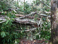
On the way down, we installed a number of additional trail signs, pictured, to help folks find their way thru the burned out areaand the heavy brush. We anticipate that there are large numbers of blowdowns on the gravel road, but we can reach them using a vehicle, at some point in the future. The heavy brush on the trail will require a major work trip early this Fall to clear. Pictured with William is one blowdown that was just too big for our chainsaw. We cleared an easy "hop over" to get past it, but hikers will encounter heavy vines until we can get back, but should be able to follow the trail.
Ernie and William Engman - 3 hours travel, 5 hours work each.
Dick and Margaret Evans - 2 hours travel, 5 hours work each.
Saturday, October 6, 2012 - BMTA TN/NC Work Trip - BMT Section 19a - Farr Gap to Slickrock Creek - Six of us suffered the cold, misty drizzle to clear the BMT of logs and do some brushing out on this section. Dick Evans was planning on meeting us at Farr Gap to join us off his BMT thru-hike, but he was nowhere to be seen, though there were lot of hunters out to bag their bear. Later we learned by email from Dick that he was indeed there, but asleep in his car up the road a ways. When he awoke, he asked around and found we had left down the trail "a long time ago". I guess he was pretty exhausted from his thru-hike and needed his sleep. Anyhoo, we encountered several quite large trees across the trail on the upper section which all had to be cleared with crosscut saw. We got maybe halfway down the mountain before turning around. In discussions with hunters we were told the trail was in good shape except down near Slickrock Creek where brushing out was needed. So we will save this for a later trip by coming in from Cheoah Dam. Volunteer hours were as follows:
Name
Travel Hours
Work Hours
Totals
Rick Harris 0.5 6 6.5 Tom Smith 1 6 7 Steve Cartwright 1.5 6 7.5 Bill Hodge 1 6 7 Peter Reber 1.5 6 7.5 Aaron Sanford 1 6 7 TOTALS 6.5 36 42.5
![]() Contact
the Webmaster
Contact
the Webmaster