
Cherokee Hiking Club
198 Crews Drive, Benton, TN 37307

Scenic Spur Trail Dayhike
Sunday, July 29, 2012
Brief Description: The trail goes to the Rock Creek Gorge Scenic area where the waterfall is located. There are two stream crossings that can be knee high depending on rainfall, so bring water shoes or wear shoes which you don’t mind getting wet. Bring rain gear and plenty of drinking water. There are no bathrooms at the trailhead
Length: 3.5 miles
Difficulty Rating: Easy
Elevation Gain: minimal elevation gain
Hike Leader: Jane Bohannon at 423-745-9534 (home) or 423-381-8388 (cell). Please call the hike leader by 9:00 p.m. Saturday evening so that she can make calls to the Cleveland people if they need to know who to connect with at the Hardee’s in Ocoee.
Directions to the trailhead from Cleveland: take Highway 64 east toward the Ocoee Rafting Area. Near Parksville Lake turn left at the Highway 30 sign. There is also a sign at this turn which says “Greasy Creek.” The trailhead parking lot is on the left about 0.2 miles north of Highway 64.
Carpooling from Cleveland: meet at the Hardee’s in Ocoee (located at the intersection of Highway 64 and Highway 411) at 2:00 p.m. Please form a carpool of your own for this group; Jane will not be coming to the Ocoee Hardee’s to meet this group.
Directions to the trailhead from Etowah: take Highway 411 south to Highway 30. Turn left onto Highway 30 at the Hiwassee Corner Market. Continue on Highway 30 to the trailhead parking area, which is on the right past the NF Work Center and about 0.2 miles from Highway 64 East.
Carpooling from Etowah: meet at the Bi-Lo parking lot in Etowah at 1:30 p.m. to meet Jane.
Everyone going directly to the trailhead should be in the trailhead parking lot by 2:30 p.m.
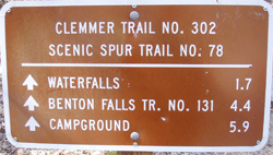
Trail Description: This trail, located near the Hwy 30/64 intersection, goes to a nice waterfall in the Rock Creek Gorge Scenic Area. Although the hike is easy, please be aware there are two stream crossings which could require wading if there has been recent rainfall. When dry, these are easy “rock-hops
Post Trip Report: Three CHC members enjoyed this warm hike with temperatures in the low to middle nineties. The water at the base of the falls and the creek crossings was refreshing. There were several hikers on the trail, and most had already enjoyed
the water at the falls or were on their way to enjoy it. We took some photos, especially Joe who is about to turn professional. We enjoyed walking with Lynne Woodside, a brand new member of the CHC who resides at Benton with her family, three goats, and a donkey. Lynn is a chemical engineer at TMG Metals at Sweetwater. Joe is also a new member of the CHC. His first hike with us was the Old Copper Road Trail in May. Hikers included Lynne Woodside, Joe Robinson, and Jane Bohannon (hike leader) and are shown in the photo.
Contact the Webmaster