
Cherokee Hiking Club
198 Crews Drive, Benton, TN 37307
Foster
Falls - Cumberland Plateau - Dayhike
Saturday, December 3, 2011
Distance: 6-7 miles
Difficulty Rating: mod. strenuous overall, but strenuous in spots-- rocky conditions
Leaders: Randy Morris: 650-0485
Brief Description: Beautiful Foster Falls is at the other end of the Fiery Gizzard area of the South Cumberland State Park from the
hike I led a few weeks back. This trail features namesake Foster Falls which has an impressive drop of 60 feet and has the most water volume of any falls in the South Cumberlands area. It has impressive overlooks, a swinging bridge and beautiful rocky gorges. A couple of the descents/climbs are steep with loose rocks so good hiking boots are a must! This will be a good hike to “pre-burn” off some of the calories from the club’s December Christmas meal that evening at Ryan’s
Meeting Place: Call Randy Morris at 423-650-0485 no later 8:30 p.m. Friday evening December 2 for meeting time/details if you are interested in attending.
Trail Description:
Post-Trip Report: Five club members drove over to Marion County on a nice December day to enjoy the beautiful Foster Falls area—part of South Cumberland State Park. We started the hike by enjoying a view of the falls from the viewing platform located just a few hundred feet from the parking lot before descending steeply to
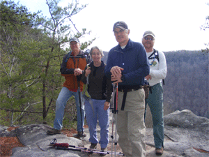
the bottom of the falls and the nice, deep pool at the base of the gorge. The week’s heavy rains had filled the creek nicely so the water volumes were spectacular. We then hiked along the base of the rock bluffs as the first rock climbers of the day were beginning to ready for their ascent up the rock faces. We ascended to the top of the gorge by utilizing the second Climber’s access trail (with the use of sturdy wooden stairs) and joined the Fiery Gizzard Trail. Once on top, we hiked along the top of the gorge for about 1.5 miles and enjoyed nice overlooks of the gorge and three smaller waterfalls plunging off the face of the cliffs. We then descended steeply down into Laurel Branch Gorge and ate lunch beside a clear, rushing stream that reminded me of the Great Smoky Mountains National Park. After lunch we climbed out of the gorge on down the Fiery Gizzard Trail. Upon our final ascent out of the gorge, “Trailblazer” Rick Harris and his trusty, GPS unit then led us around the gorge on a “bushwhack” that allowed us to explore new territory while avoiding a backtrack into Laurel Branch Gorge. We regained the trail exactly where the GPS indicated we would, and then hiked back on the Fiery Gizzard Trail to the parking lot. Along the way we experienced views of Foster Falls from the opposite side of the gorge, a great small waterfall at a 90 degree angle to the main stream, and the beautiful rapids of the creek above the falls. You can check out our route on the club’s website at www.cherokeehikingclub.org. Hikers enjoying the 6 mile trek were Buddy Arnold, Dave Flower, Rick Harris, Kathy Seymour and hike leader Randy Morris.
Contact the Webmaster