
Cherokee Hiking Club
198 Crews Drive, Benton, TN 37307
Bob Bald / Hangover Dayhike
Saturday, September
11, 2010
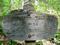
Brief Description: This moderate hike will take us from the Wolf-Laurel Trailhead up the Stratton Bald Trail to Stratton Bald, then over to Haoe and the Hangover where we will eat lunch. Then we will exit via Bob Bald and the Fodderstack/Benton MacKaye Trail to Beech Gap. We will then finish our shuttle and go to the Harris's log home in the mountains for dinner for all.
Length: about 10 miles
Difficulty Rating: moderate due to the elevation rise
Elevation Gain: about 800 feet from the Wolf Laurel Trailhead at 4550' to Stratton Bald at 5336'
Hike Leader: Rick Harris, 423-253-6358, harrisri@aol.com
Directions to the Trailhead: We will meet at the Tellico Plains Hardee's at 9A
M, then do our shuttle, leaving cars at Beech Gap then taking the Santeelah Creek Road to the Wolf-Laurel Road up to the Wolf-Laurel Trailhead. After the hike, we will have to retrieve our cars at the Wolf-Laurel Trailhead,
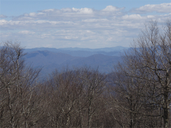
Trail Description: This trail is one of the most scenic to be found anywhere. From the Wolf-Laurel Trailhead, we will climb up Stratton Bald Ridge to the top of the mountain at 5336 feet. We will then hike on the Haoe Lead trail out to Naked Ground, then out to the top of Haoe and on out to the Hangover. From the Naked Ground campsite, it is almost a sheer drop off for thousands of feet with grand vistas looking into NC. The Hangover is what its name implies, a rocky outcropping with full 360 degree views of the surrounding mountains. At the very end of the trail, there is a sheer drop off of several hundred feet, which is hanging over the bluffs a little bit. It makes you dizzy and it is a little scary. The trail dr
ops about 500 feet to Naked Ground (elevation 4860') on a ridgeline trail, then climbs back up about 500 feet to Haoe, then down
a couple hundred feet to the Hangover. From the Hangover, we will return the way we came but continue on the Stratton Bald Trail to Stratton Bald, then we will go on down to the little bit lower Bob Bald at 5294 feet which is a big open field with 360 degree views of the surrounding Tennessee and NC mountains. Will will then continue on down the Stratton Bald Trail west to its intersection with the Benton MacKaye/Fodderstack Trail, then head north to Beech Gap on the Cherohala Skyway at the state line. These trails in places are steep and in other places are in a rhododendrum thicket which as its name implies is "thick"... Though the total elevation gain is not all that much, about 800 f
eet, you will know at the end that you have been challenged. But the challenge is well worth it.
Post Trip Report:
Contact the Webmaster