Cherokee Hiking Club
198 Crews Drive, Benton, TN 37307
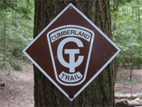
Signal
Point - Cumberland Trail Hike
Saturday, May 24, 2008
Brief Description: This 10.4 mile hike on the top of Signal Mountain near Chattanooga is part three in the series of hikes which are
part of the southern terminus of the Cumberland Trail. Part one was our hike on the Mullins Cove Loop. Part 2, is the Pot Point Loop Trail. Today we had intended to hike the Pot Point Trail, but we changed our minds and decided to hike the segment from TN27 to Signal Point, since some of us had never hiked this
segment except for the trail from Signal Point to Edwards Point. The official signed distance from TN27 to Signal Point is 8.4 miles, but my GPS registered 9.2 miles. This is a very scenic section of trail which is very well maintained. The views looking down into the Tennessee River Gorge are fantastic and well worth the hardships of the trail.
Length: Though the literature says 8.4 miles, it may be a little longer, according to my GPS. We also hiked from TN27 up the hillside to the west to the junction with another access trail and back, an additional 1.2 miles round trip, for a total of 10.4 miles.
Difficulty Rating: Moderate due to length and the amount of roller-coasting
Elevation Gain: A few hundred feet, not too bad if it were not for all the ups and downs within those few hundred feet.
Hike Leader: Rick Harris, 423-253-6358, email HarrisRi@aol.com
Directions to the Trailhead: We will meet at the Park and Ride lot on the southwest corner of Exit 25 in Cleveland at 8:30 AM, or at the Burger King Parking Lot at the base of Signal Mountain on US 127 at about 9:15 AM. Please let the leader know 1) if you are going and 2) where you will join us, by no later than Friday evening at 6PM. After it is known who is going and where people are meeting, then the leader will send out an email (or call those without email) to confirm plans.
Trail Description: We will start from the TN27 parking area and hike to Signal Point Point. We will probably eat lunch at the Edwards Point Overlook. After the hike, we will eat dinner at the Italian Restaurant on top of Signal Mountain, the same place we ate on the Mullins Cove hike, Pastaria.
Post Trip Report: This being the Memorial Day weekend, we only had 4 hikers for this trip: Rick & Brenda Harris, Steve Kidd, and Randy Morris. We parked one car at Signal Point, then drove to the TN27 crossing of the
Cumberland Trail. We hiked first west up to the escarpment to the junction with the access trail then back (0.6 miles each way). Then we crossed the road and finally found the trail down to the bridge across South Suck Creek heading towards Signal Point. It was quite hard to find the trail because of a lack of trail signage along the road and the fact that the trail leaves the road several hundred feet down the road from where the one trail sign is present on the road. This definitely needs to be fixed to prevent consternation by future hikers. We also met there a man and his 10 year old son who were heading off on a weekend backpack trip going our same direction. This was the boy's first backpack trip and he looked quite excited about the prospects of a weekend with dad out in the woods.
We hiked across the bridge, then up onto the saddle between North and South Suck Creeks then down to the North Suck Creek bridge. There is a beautiful campsite right on the creek below the bridge at this point. This is the site the man and his son planned to camp that night. The creek at this
point looked like a great place for the boy to swim. He hopefully had a great time. We then headed up the side of the mountain, then along the escarpment to Edwards Point. We ate lunch on the way at a little waterfall and at Edwards Point we gazed into the void and took lots of pictures. We watched a couple of red-tailed hawks and other birds of prey float on the thermals in the area. The views up the gorge and down toward Chattanooga and Baylor School with Lookout Mountain in the background are fantastic.
We then headed on down the trail, dropping down to the bridge over Rainbow Creek, then back up to Signal Point, where we had our shuttle car parked. From there we drove the short distance to Pastaria for a wonderful Italian dinner, then returned to our home. It was a great trip, though it was rather hot and muggy. The mountain laurel, flame azaleas, and rhododendron were in full bloom.
Contact the Webmaster