Cherokee Hiking Club
198 Crews Drive, Benton, TN 37307
Cooper Gap
Horse Trail
Starr
Mountain Dayhike
Saturday, March
29, 2008
Brief Description: We will hike the Cooper Gap Horse Trail on Starr Mountain (Horse Trail 119) from the trailhead at the base of the mountain just northeast of Etowah up the mountain side to the top, then follow the old forest service road to the firetower at 2185 feet. We will return by the north arm of the Cooper Gap Trail. This trail has great views off the sides of the mountain The trip up from the bottom involves about a 1400 foot climb up switchbacks.
Length: 11.4 miles
Difficulty Rating: Difficult due to length and elevation gain of 1400 feet
Elevation Gain: 1400 feet up switchbacks
Hike Leader: Clayton Pannell, 423-263-9730
Elevation Profile of the Trail
Access Map to the Trailhead
Directions to the Trailhead: We will meet at the Etowah Bi-Lo at 8AM and carpool to the trailhead. To reach the trailhead from Etowah, go east on Mecca
Pike (TN 315) 0.7 miles to Greens Road (CR 881). Turn right on Greens Road and go 0.2 miles, then bear left onto Old Mecca Pike Springs Road (CR 475). Go 1.0 miles to CR 880. Turn right onto CR 880 and go 0.8 miles to a grassy parking area just below the forest service gate. This is the trailhead.
Trail Description: From the trailhead, we will head up the south arm of the Cooper Gap Horse Trail and follow it to the top of the mountain, quite a climb, but not too steep. The total elevation gain to the fire tower is 1600 feet. Once we hit the ridge line, we will turn left onto the forest service road and go about a half mile to the entrance road to the fire tower. This road is fairly steep up to the tower. We will then return to Cooper Gap and follow the north arm of the Cooper Gap Horse Trail back to our cars.
Post Trip Report:
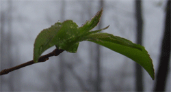
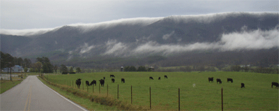
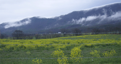
Six hikers meet in the Etowah Bi-Lo parking lot on a rainy morning to do a hike on the North end of Starr Mt. With two vehicles started for the trailhead the route took us through the Huff Dairy farm, with its fields of yellow flowers. We arrived at the trail head and most put on their rain gear and started our hike. We hiked up the road to the top of Starr Mountain and then out the top and up some more to see a fire tower in the fog. On our return after lunch, we descend on another trail, part of which was very steep. Total Miles 11.4. Hikers were Clayton Pannell leader, Richard Harris, Brenda Harris, Steve Kidd, Jim Runyon and Jane Bohannon
Contact the Webmaster