
Cherokee Hiking Club
198 Crews Drive, Benton, TN 37307
Mullins
Cove
Loop Dayhike
Saturday, March 1,
2008
March 1 – Mullins Cove Loop, 10.2 miles (Difficult), 6.7 miles (Moderate) or 3.5 miles (Easy).
Hike Leader: Richard Harris, 423-253-6358 (h) or 513-260-1184 (c) or HarrisRi@aol.com
Trailhead: Drive to Chattanooga on I-75, then I-24. Take the US27 North exit into Chattanooga, cross the Tennessee River, then exit onto US127 North toward Signal Mountain. Follow this to the base of Signal Mountain and turn left onto TN27. Follow TN27 for 8 miles and turn left at the large Prentice Cooper State Forest sign. Follow the signs into the forest. At 3 miles from the TN27 intersection, you reach the Cumberland Trail parking lot, and at 6.1 miles, you reach the Snooper's Rock parking lot.
Those who wish to carpool should meet at the Cleveland Park & Ride at exit 25. When you get off Interstate 75, go west to the traffic light. The Park & Ride is on your left. We will leave from there promptly at 8:30 AM.
Trail Description: This hike will begin at the Cumberland Trail Parking Area off of TN 27 on top of the Cumberland Plateau within the Prentice Cooper State Forest and Wildlife Management Area. The long
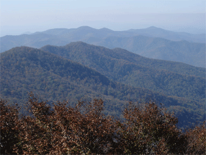
loop hike will begin at 10 AM and will go clockwise to the Rock House, then to Snooper's Rock. At Snooper's Rock, we will meet those taking one of the shorter routes at 11:30 AM. This first section overlooks the Tennessee River Gorge, made famous in the Davy Crockett movie "A Light in the Forest" and is where the Tennessee River passes through the Cumberland Plateau. The hike will then cross over the plateau to the escarpment above Mullins Cove. We will follow the trail along the escarpment, then will drop down into the gorge for the last 3 miles of the hike. We will end up at the parking lot where we left our car. Total distance 10.2 miles. Some of the trail, especially that down in the Mullins Cove Gorge is quite rugged with significant boulder hopping.
Those who wish a shorter hike should join us at 11:30 AM at Snooper's Rock. Drive down Tower Drive past the Cumberland Trail Parking lot, then past the fire tower and on to the parking lot for Snoopers's Rock. You can park on Tower Drive in the parking lot there or drive down Snooper's Rock Road to a parking lot right at the overlook. It is a 0.3 mile hike down to the overlook from the parking lot on Tower Drive. Either way, meet the long loop hikers at Snooper's Rock at 11:30 AM. From there you can either go counterclockwise (3.5 miles to the Cumberland Trail Parking Lot) or clockwise with the long loop hikers (6.7 miles to the Cumberland Trail Parking Lot). If you take the short route (3.5 miles), you will need to leave a car parked at the Cumberland Trail Parking Lot for your shuttle since you will get back way before the rest of the group. If you take the intermediate route (6.7 miles), then we can shuttle you back to your car at Snooper's Rock.
Regardless of what your plans are, please contact Richard Harris to let him know what they are. You should not show up at the trailhead unannounced.
Post-Trip Report: Eight hikers made the long trek to the Chattanooga area to hike the Mullins Cove Loop
on the back side of Signal Mountain in the Prentice Cooper State Forest, including Rick and Brenda Harris (and Jake, their Golden Retriever), Steve and Dottie Kidd (visiting from Florida), Mae Miles, Donna Brandon, Jim Runyan, and James Anderson. It was a gorgeous clear sunny day with temps up into the middle to upper 50's with a mild refreshing breeze. We started from the Cumberland Trail parking lot and hiked clockwise. Our first stop was the slot down into the Rock House, then we hiked along the escarpment above the Tennessee River downstream for over 3 miles to Snooper's Rock, where we ate lunch. We then crossed the plateau to the western side overlooking Mullins Cove, taking a break at an overlook above the bluffs. We then did a lot of "undulating" up and down every creek valley until we reached the escarpment above the East Fork of Mullins Creek. We dipped down into the rock garden along the creek, carefully working our way up the creek bed back up onto the escarpment and returned to our cars. The total distance was 10.2 miles.
Afterwards we drove back down the mountain, then up onto the top of Signal Mountain and ate a delicious Italian dinner at Pastaria, a local favorite. We got there about 5PM, and were immediately seated. But soon the restaurant filled up and there was a long waiting line when we left. We then drove down to Signal Point to see the sunset over the western mountains and to watch the lights of Chattanooga and Lookout Mountain become visible.
In all it was a great trip with wonderful weather, great vistas, and great food.Submitted by Rick Harris
Contact the Webmaster